I first stumbled across Arizona’s Wave when perusing the New York Times Travel section. It was hidden at the back of an online slideshow of reader-submitted travel photos, and it took about two seconds of reading through the accompanying story of the father-daughter duo who hiked the rugged sandstone formation’s undulating and trackless forms together before I had chosen my next adventure. I had to see it. The problem? Well, many. The overarching one, however, was a lack of insider tips and information—especially relating to hiking the Wave in the winter off-season (which, I might add, is a spectacular time to see it). So six months and many near-catastrophic missteps later, here it is. Read on to learn about the potentially dangerous winter obstacles you’re likely to encounter on your way to the coolest sight of your life and how to avoid being killed by them. (Just kidding! Kind of.)
Obstacle #1: Obtaining a permit. Although in no way deadly, obtaining a permit is first in the line of Wave obstacles and takes perseverance, dedication, and knowledge of the system to successfully tackle. Here’s some background: to preserve the area’s delicate terrain and to level the playing field for everyone who wishes to visit, the Bureau of Land Management (BLM) issues only 20 permits per day—ten on the first of each month via an online lottery and ten each morning for walk-ins. While permits for Paria Canyon’s Coyote Buttes South are usually available, permits for Coyote Buttes North (where the Wave is located) are much more difficult to obtain. The odds of winning the online lottery for April-June and September-November were about 4-5% for 2013, while off-season months varied from 8% (August) to 25% (January). Yikes.
Armed with this knowledge, I strategically (or so I thought) entered on the last day of each month for three months straight, hoping to increase my chances by swooping in at the last minute and choosing the day with the least amount of requests. This failed. Even though it was the off-season, the number of permit requests per day never dipped below 400. Needless to say, I went 0 for 3. But I was determined, and luck came my way when I decided to go for the third and recommended port of entry: the cancellation calendar. One serendipitous November day while I was taking a “break” at work (i.e. not working), two permits for December 19th miraculously appeared on my screen. And I impulsively bought them. Even more miraculously, I was able to get three days off of work, and my friend Janie was scheduled to finish her last semester of college two days before the permit date. She finished her finals on a Tuesday night, and we hit the road for the Arizona-Utah border before dawn the next morning. We arrived in Kanab 12 hours later, which is a small and lovable Utah town an hour away from the Wave. Here, most hikers spend a restless night before their short yet highly-anticipated six-mile trek.
Obstacle #2: Surviving House Rock Valley Road. And then there was the road. Listen up, people—this is important. If you learn only one thing from my first-hand account, learn this: when the BLM says that “A four-wheel drive, all wheel drive (AWD) vehicle is highly suggested,” what they really mean is “drive a four-wheel all wheel drive (AWD) vehicle or YOU WILL FLIP/TOTAL YOUR CAR, CRITICALLY INJURE YOURSELF AND PASSENGERS, AND/OR HAVE TO BE TOWED.” Why, you ask? Four words: House Rock Valley Road. This treacherous, non-maintained, eight-mile stretch of gravel must be successfully traversed in order to reach the trailhead, and it’s a doozy—especially in December. At colder temperatures, it morphs into a formidable slip and slide of ice, mud, and sky-high ass-slamming divots that will rip your shoes off and make you and your new death-mobile feel like you’re ice skating in socks. Did I mention the intermittently steep drop-offs and lack of cell service?
We were luckily tipped off about the 4WD the night before our hike date, when we called into the Kanab Field Station to double check directions and information regarding getting to the trailhead. Mention of my 2WD Scion xA was immediately followed by (justified) scolding, annoyed reiteration that Scion + House Rock Valley Road = obvious death trap, and convenient redirection (perhaps too conveniently…) to a local Jeep rental business down the street from the Kanab Field Station that fortunately rented to 21-year-olds. Any suspicion of snaky business promotion, however, was quickly dispelled when we frantically walked in the next morning and were warmly greeted by the shop’s kind owner and his gargantuan dog Bear, who liked to sit on the couch with his front paws on the floor (because his body was too big to fit on the cushions) and nod off until the weight of his slowly drooping head offset the delicate balance between rear and paw and jolted him awake. Although two hours behind schedule and $140 in the hole, we were finally ready to go. And after an epic hour of driving 10 mph and clinging to our new ride for dear life, we defeated Rock House Valley and made it to Wire Pass trailhead by 10:30 a.m. to start our long awaited hike.
Obstacle #3: Finding the Wave. For those who have little to no experience navigating in unmarked wilderness, finding the Wave in an area as vast and sprawling as Coyote Buttes can prove a sizable challenge. What makes navigation even harder is the unique sandstone terrain; depending on the positioning of the sun, shadows can transform your original path into looking like completely different and uncharted territory on the way back. To further complicate matters, the hard terrain also leaves no trace of footprints to look to in times of navigational crisis.
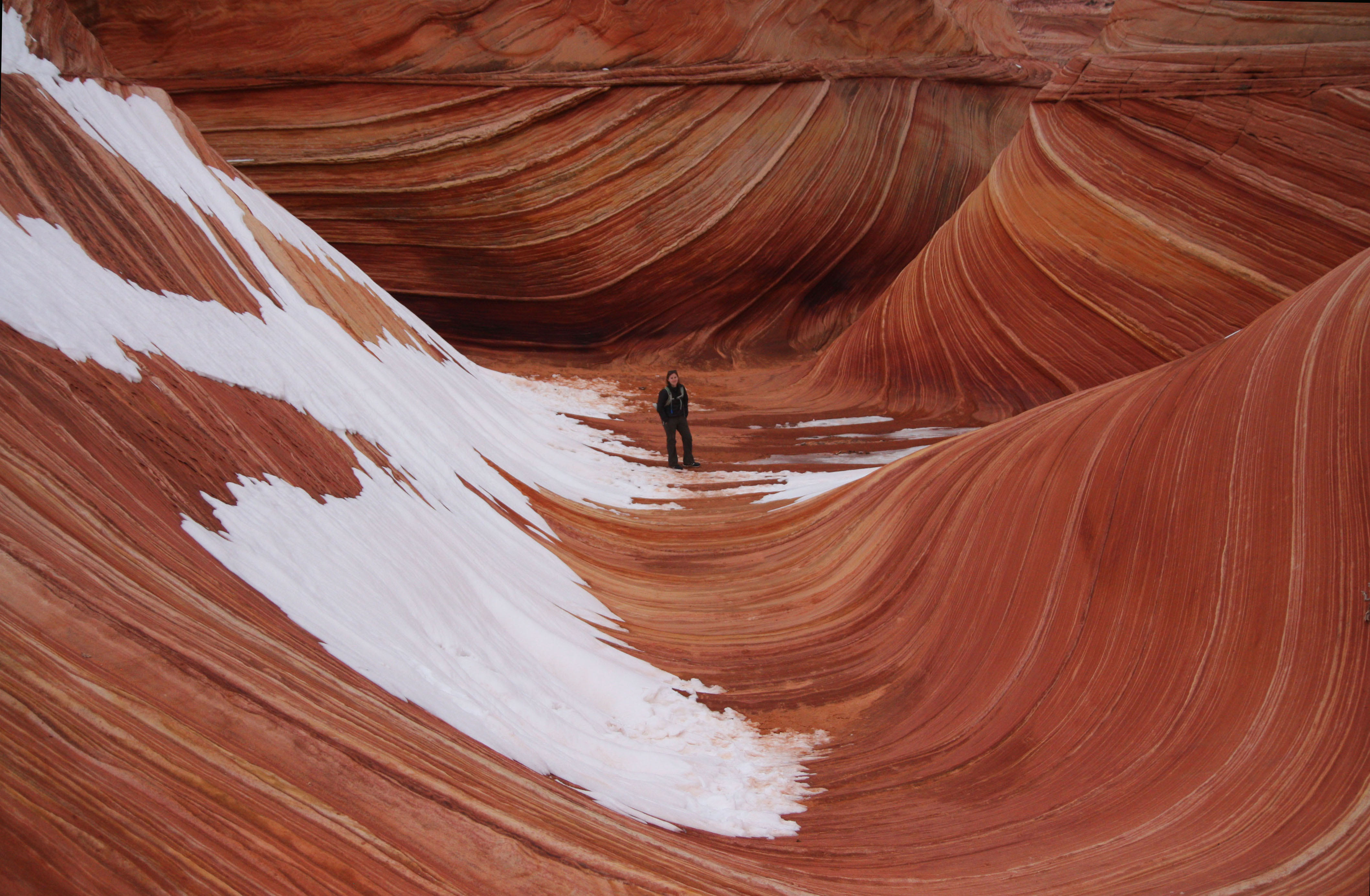
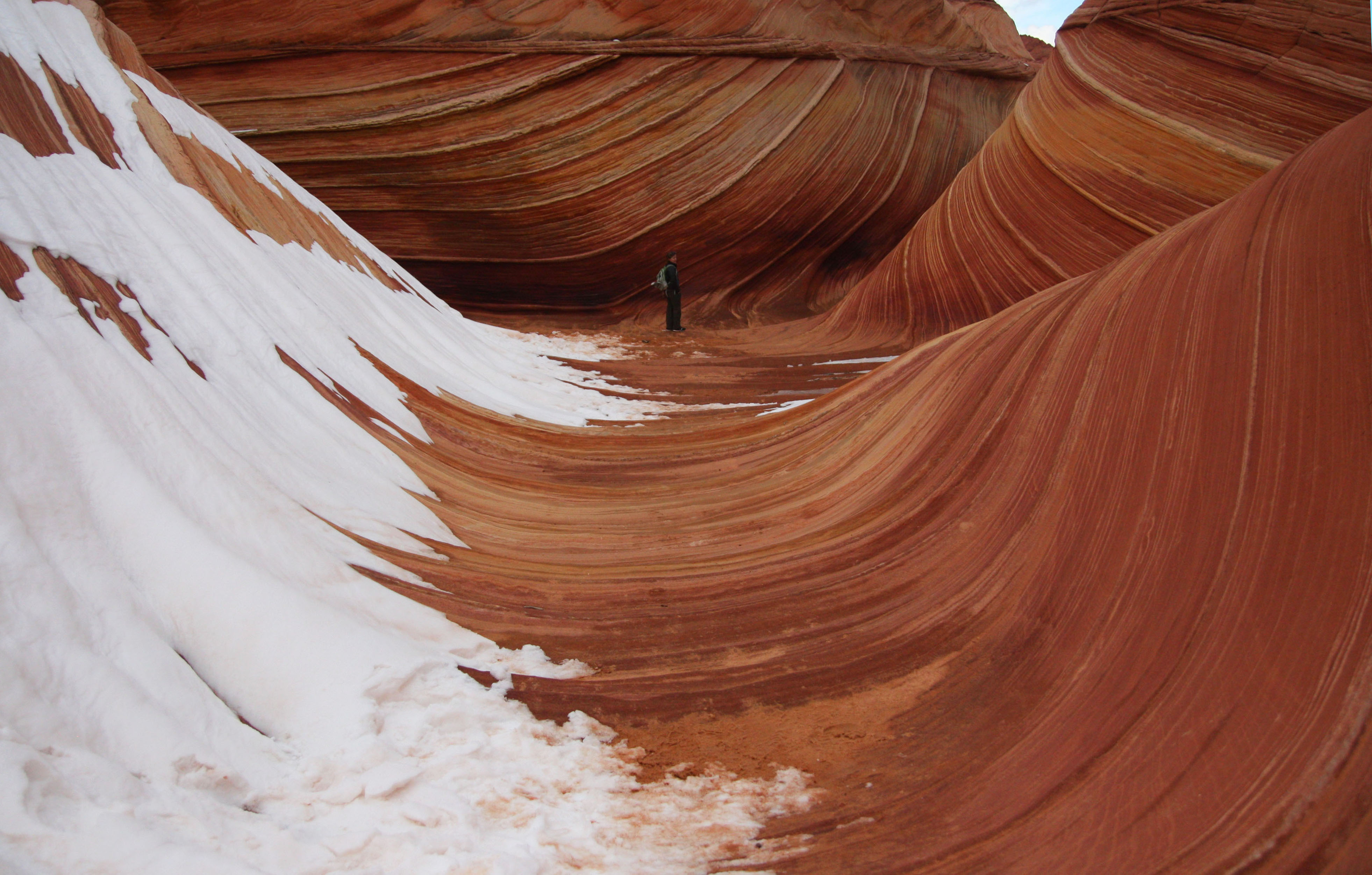
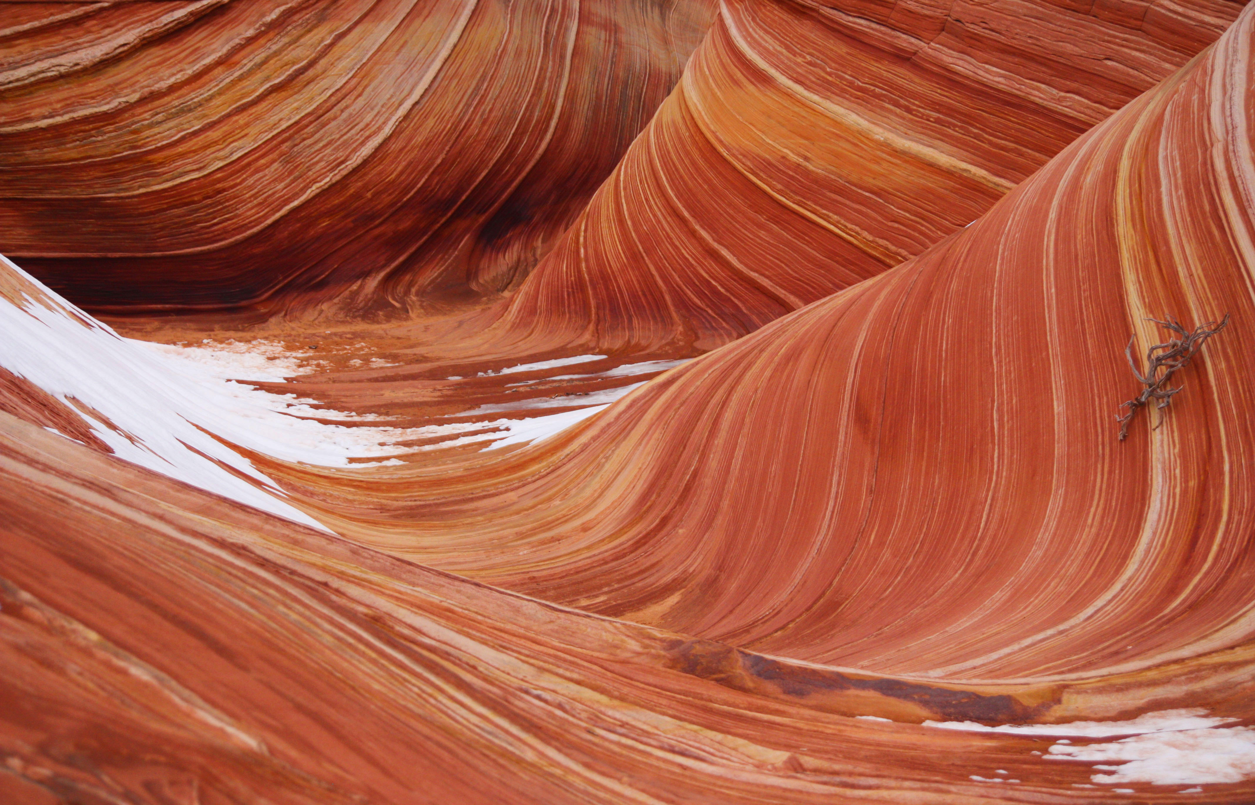
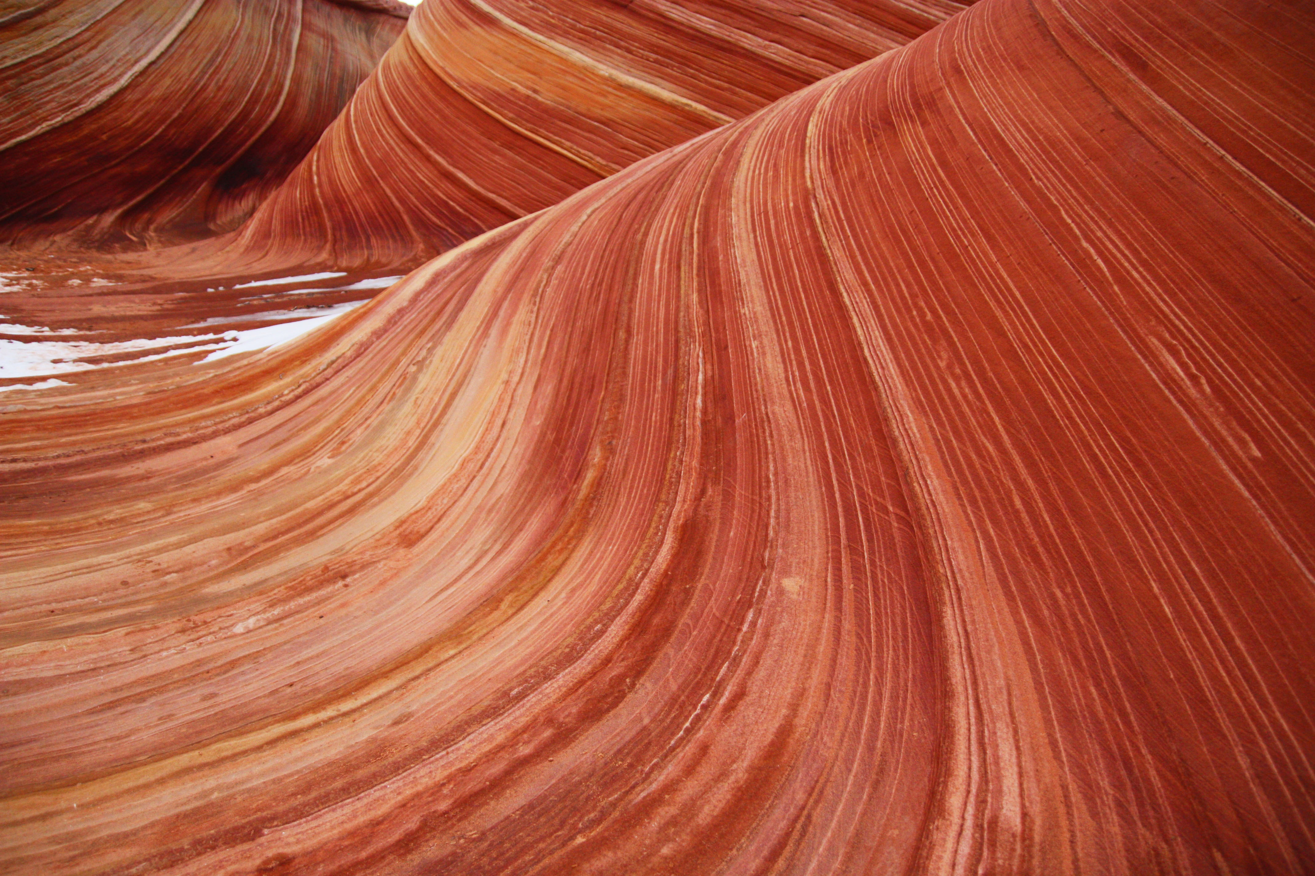
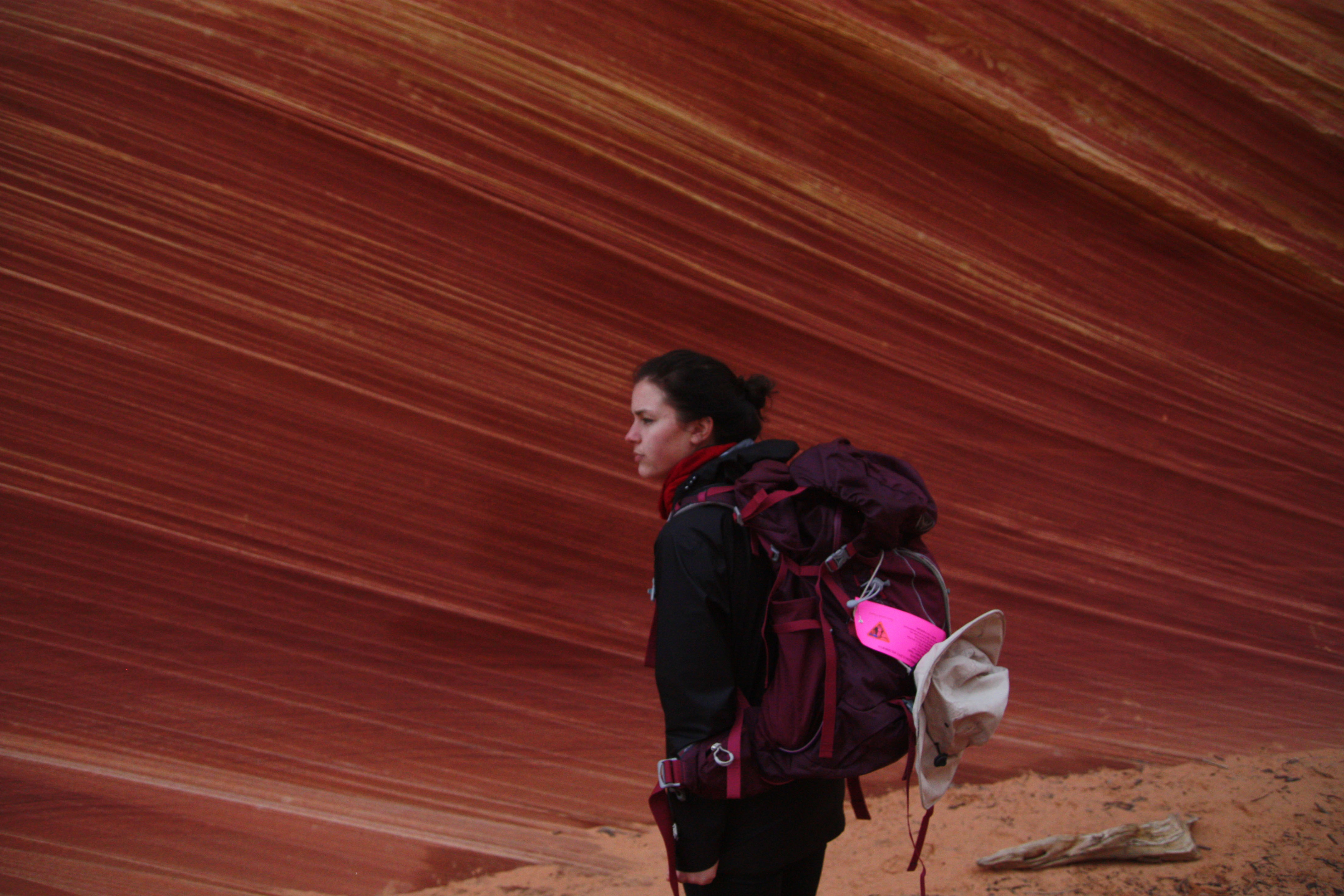
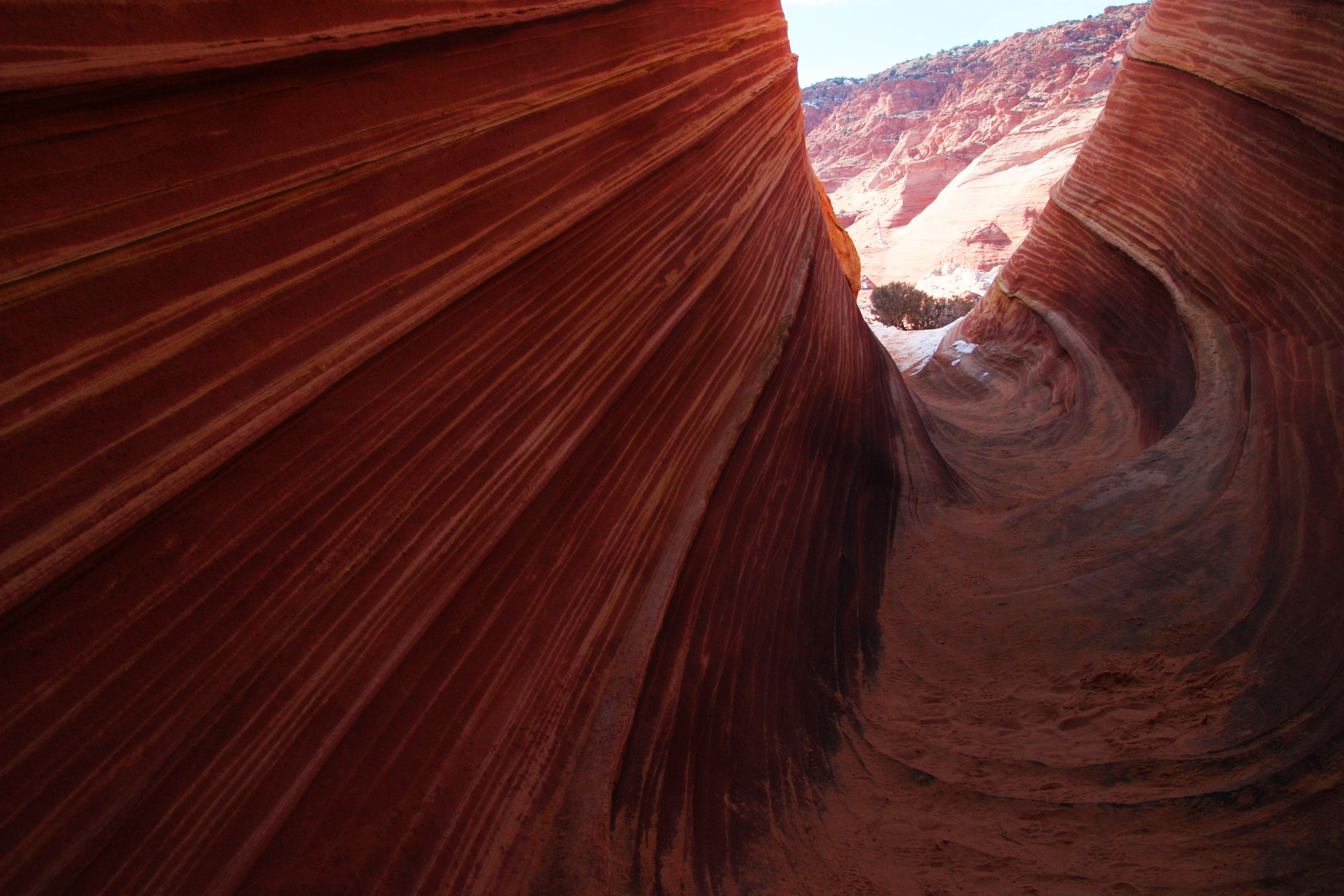
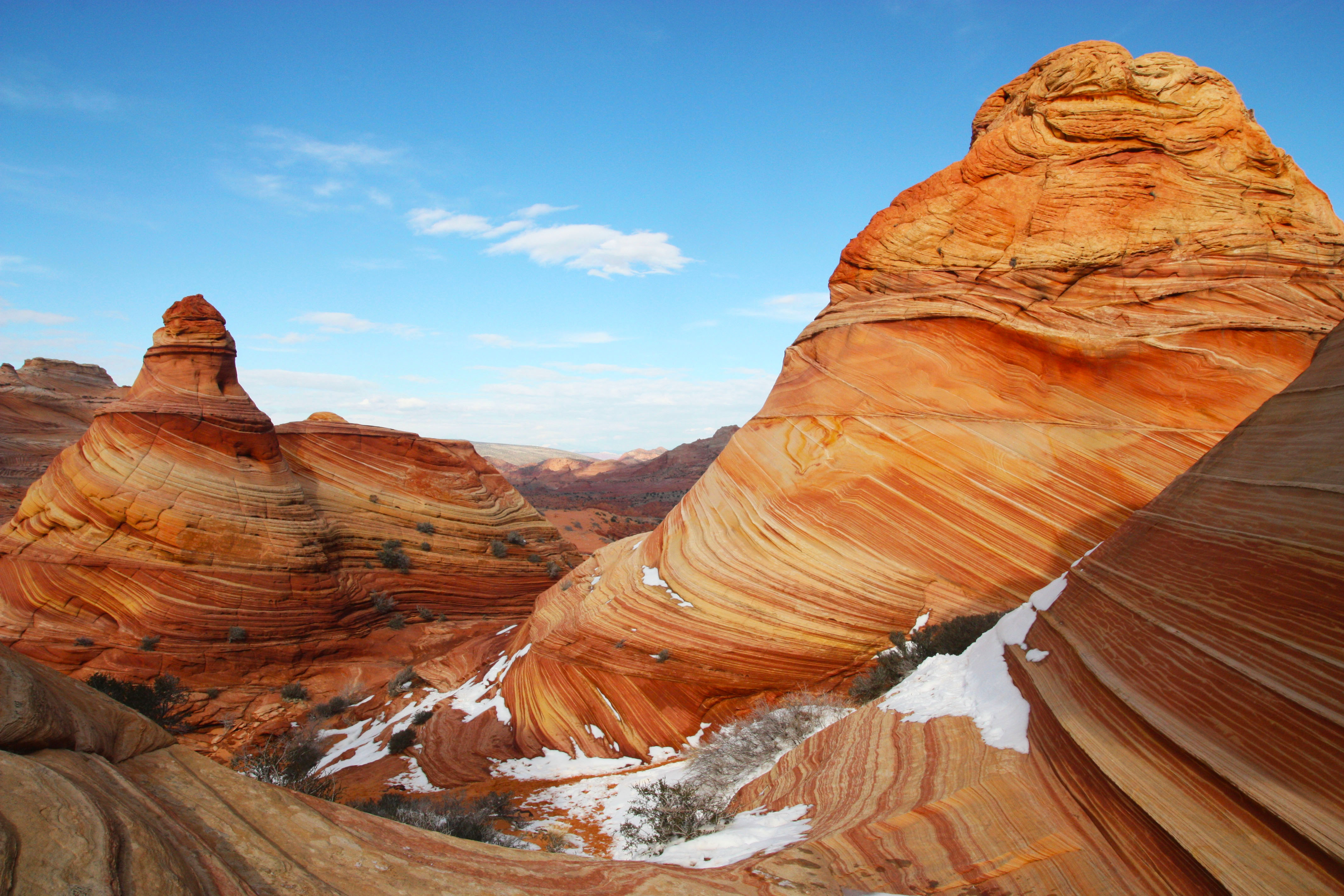
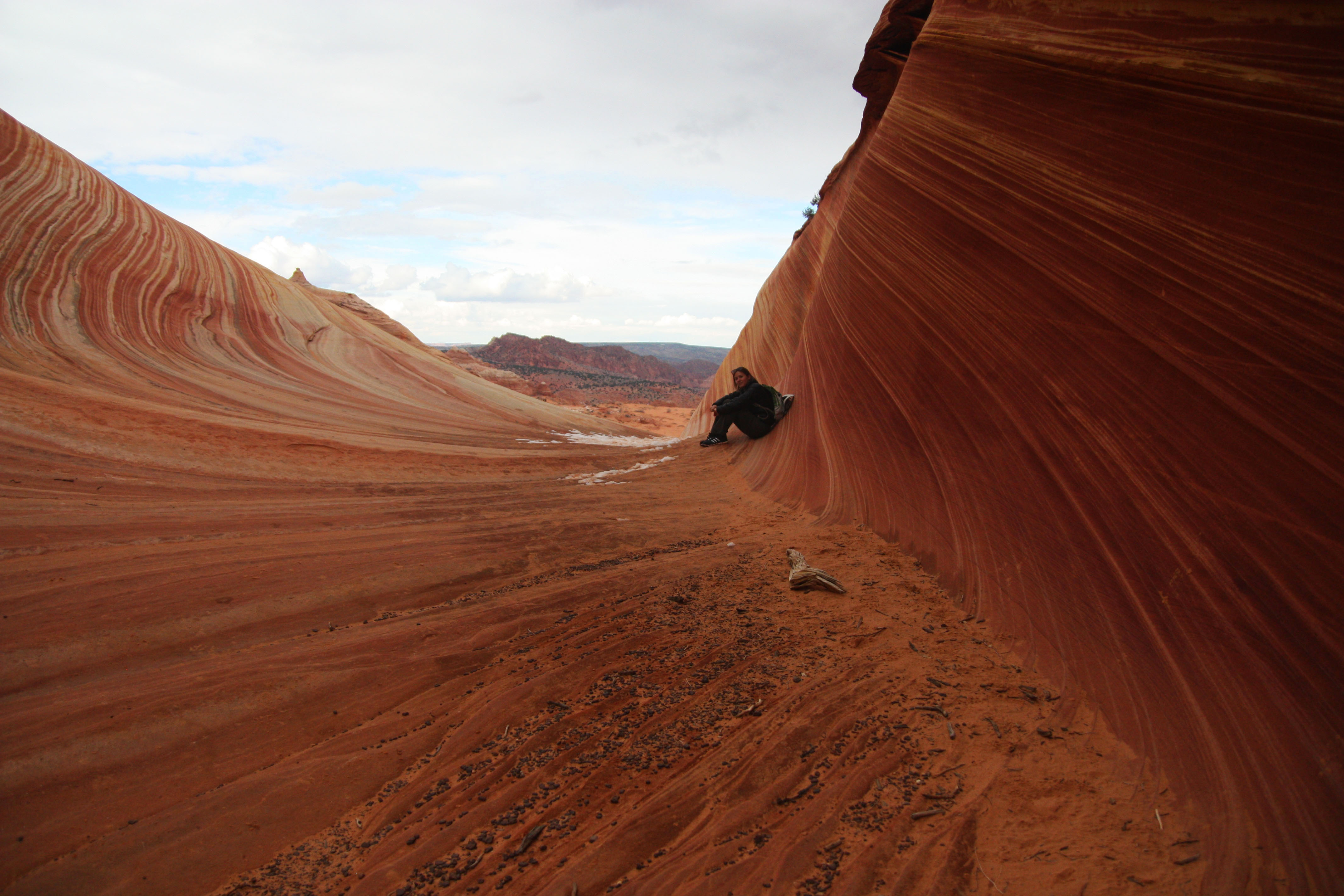
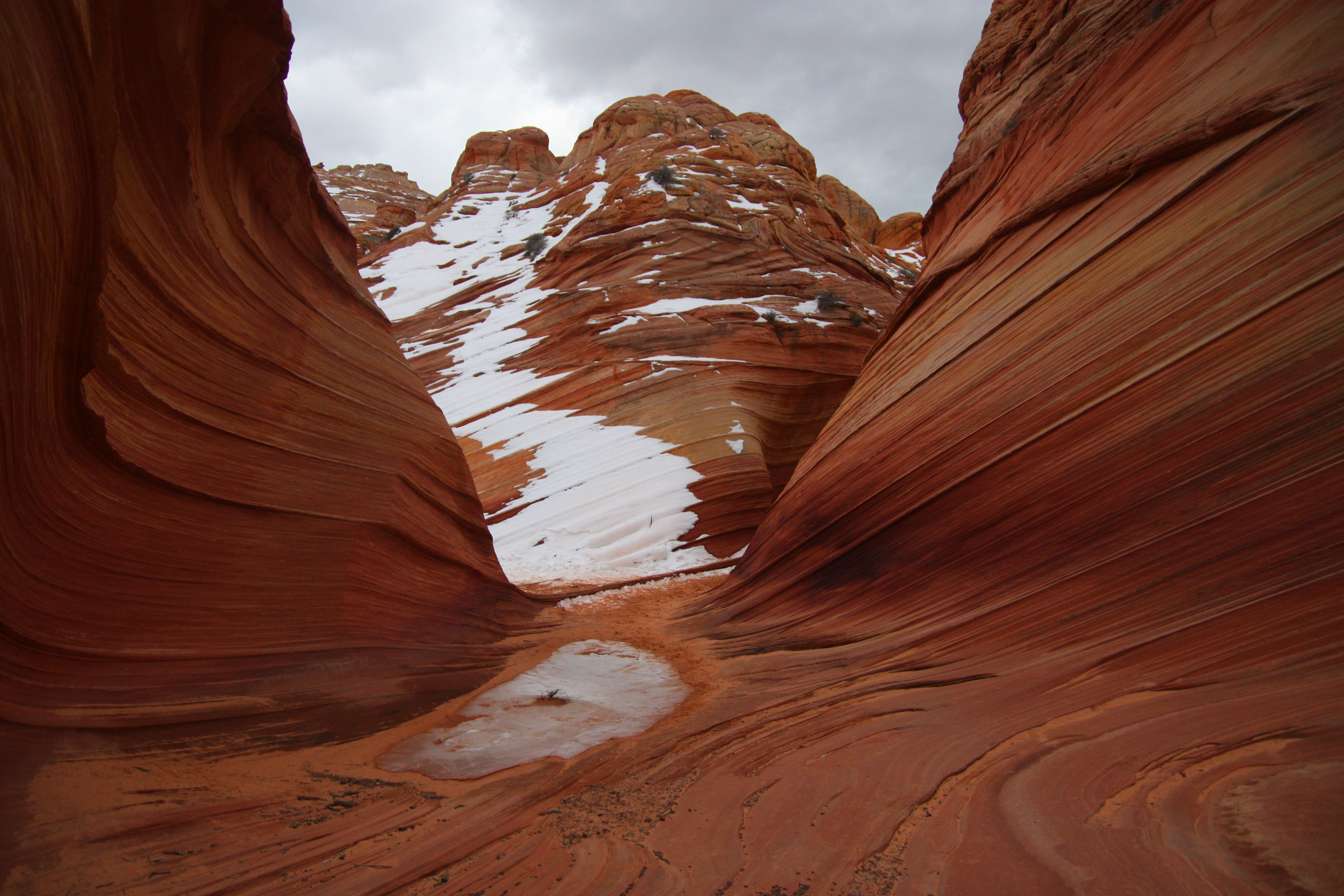
To help hikers, the BLM sends a map with detailed instructions and pictures of six different checkpoints along with your permit. The problem is this: the pictures all look the same. As far as Janie and I could tell, anyway. But we had an advantage. Hiking in the winter meant snow on the ground, and snow meant footprints. Which are exactly what Janie and I followed, closely monitoring our path with her GPS in case of emergency. Essentially riding the stress-free coattails of the two navigational ninjas ahead of us, we reached the Wave in great time. And spent the next two hours wandering around in awe and disbelief taking pictures like this:
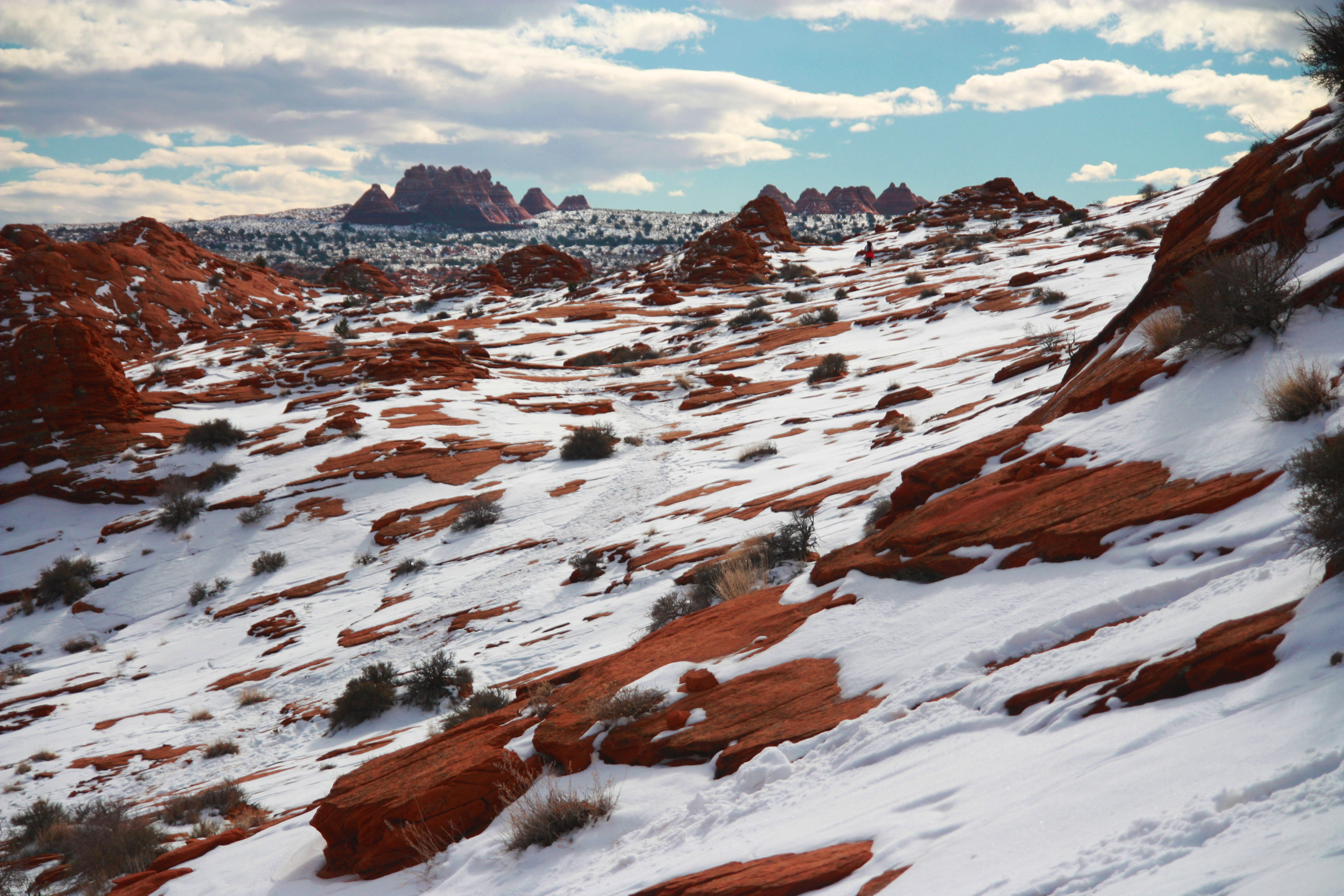
Obstacle #4: Finding your way back. The way back was far more difficult. Partly because we had to tear ourselves away from the Wave, but mostly because we had lost our brilliant and navigationally talented guides. Beautiful sun had turned into ominous clouds, and the way we thought we had come now looked unfamiliar. There were also no footprints to be found. The number of threatening animal prints, on the other hand, had exponentially multiplied. Then we heard the chopper, circling low over the Wave and eventually flying directly overhead. Oh no, were they looking for us? Were the two idiots who were going to use 2WD also stupid enough to overlook the clause about the bloodthirsty coyote packs that devour any hikers out after 3pm?! Of course not. But that’s what we thought, and we spent a full ten minutes panicked and legitimately lost on a seemingly dead-end cliff in the freezing Utah-Arizona winter wilderness before we pulled our heads out of our brick-shitting behinds and found the trail using our GPS. I highly recommend bringing one–you won’t regret it. We made it safely back with plenty of time to spare before sunset, but others had not. We learned from a ranger stationed in the parking lot that a party of three had gone out the previous day and never returned to their still parked car.
Over the course of the conversation, we also learned that three people had died hiking to the Wave the past summer—one older couple and one mid-twenties female. With little to no shade in 100+ degree temperatures and no way to send for help, all three died of dehydration before anyone even knew they were in trouble. Like every other untimely piece of information I learned on this trip, I couldn’t tell if I was more relieved or outraged that the first time I heard it was after the fact.
And there was one more piece to go. As I turned to head back to my car, the ranger asked, “Which direction are you headed back? North or South?”
“Oh, I don’t know,” I responded. I guess the way we came.”
“Oh, okay,” she cheerfully remarked. “That way is fine, but you’ll probably have to be towed.”
Not an ounce of sarcasm or smart-assery to be found. She was cheerfully serious; out here, having to be towed seemed a normal and “fine” thing to have happen to you. We unsurprisingly chose to go the other direction, a different and slightly less treacherous road that spanned 22 miles instead of 8 and took us a whopping 2 hours to swerve our way through in the dark. But hey, we didn’t have to get towed. I’ll take it.
 *Photos by Anna Pieper and Janie Hensel
great article about a fantastic “hidden” spot in the Coyote Buttes North. We were lucky to win The Lottery twice(on 2 participations). Once online in April 2013 (http://kalaman0032apr2013.blogspot.be/2013/04/01-april-kanab-wave-page.html) and also a walk-in permit last December (http://kalaman0032dec2013.blogspot.be/2013/12/18-12-2013-wave.html). We also went to the local Jeep-rental, but because of our European drivers license we could not rent one. The dog was exactly in the same position :-). We went with the Paria Outpost shuttle service and hardly managed the way back (north) because of all the mud (see short movie on our blog). Unfortunately you didn’t explore the area around The Wave as the Second Wave, The Sand Cove, Dinosaur Tracks and especially Fatali’s Boneyard (see blog December)…