Our Favorite Places, Parks, Drives, and Campsites in Alaska
For the past 9 months, my partner and I have been living, traveling, and working out of our Rocky Mountain 4 Wheel camper / 20 year old Toyota Tacoma. During that time, we traversed most of the United States and British Columbia – From Chicago, to Key West, to the northern slope of the Brooks Range (Arctic Circle), then back again. We spent 2 months in Alaska, and it turned out to be our favorite destination so far. Below is a list of our favorite hikes, campsites, breweries, and other destinations around Alaska (That we’ve seen so far; there are lots of amazing destinations that we missed and hope to hit another time). Enjoy!
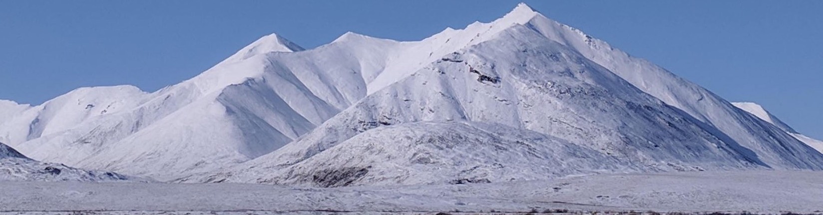
Gates of the Arctic National Park, Arctic Circle
This is our favorite national park, and we barely made it past the outer boundary. The National Park Service calls Gates its ‘crowning jewel’ and ‘the last true wilderness,’ and for good reason. There are no roads into the park, and the closest the Dalton Highway comes is 5 miles from the outer boundary. There are no trails either, so you’re on your own to make your own way hiking and exploring. The park is part tundra (i.e. above the tree line of the arctic), partially below the tree line, and entirely well above the Arctic Circle on the Northern Slope of the arctic.
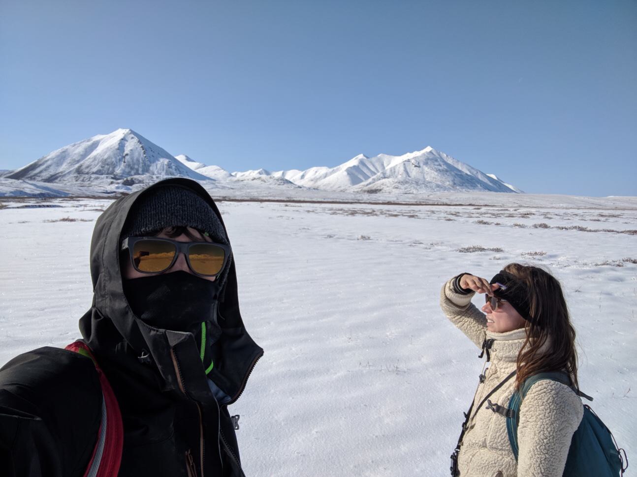
I felt like a displaced being on a foreign world most of the time. The feeling is similar to the one I get in really remote places in the American southwest, which is probably why Alaska and the southwest are my two favorite areas in the US. We arrived during a freak late August blizzard, so day 1 had little-to-no visibility, which added to the aura. Day 2 didn’t have a cloud in the sky, and was the first bluebird day we had in 4 weeks. It was stunning. We could see for miles since there were no trees and we were in a giant valley between various mountain ranges. There are a bunch of pull offs and free camping areas, but you should expect to see no one else while you’re in the park (and few to no others while on its boundaries), so you need to be comfortable with being extremely isolated, remote, and surrounded by nothing but pure, unaltered wilderness.
Location / Driving near Gates of the Arctic – The southern boundary of the park begins near Coldfoot, and ends basically where we camped (about 100 miles north of Coldfoot). It only took us 4.5-5 hours to drive to Coldfoot from Fairbanks, and under 2 hours to make it from Coldfoot to the upper boundary. Coldfoot is about 250 miles from Fairbanks, and the upper boundary of the park is around 100 miles north of Coldfoot (Prudhoe Bay is about 250 miles north of Coldfoot). Although the Dalton is 75% dirt / gravel, and there are potholes, it’s not nearly as treacherous as people make it out to be (or it used to be). We went 60 mph most of the time, and were just cognizant of potholes.
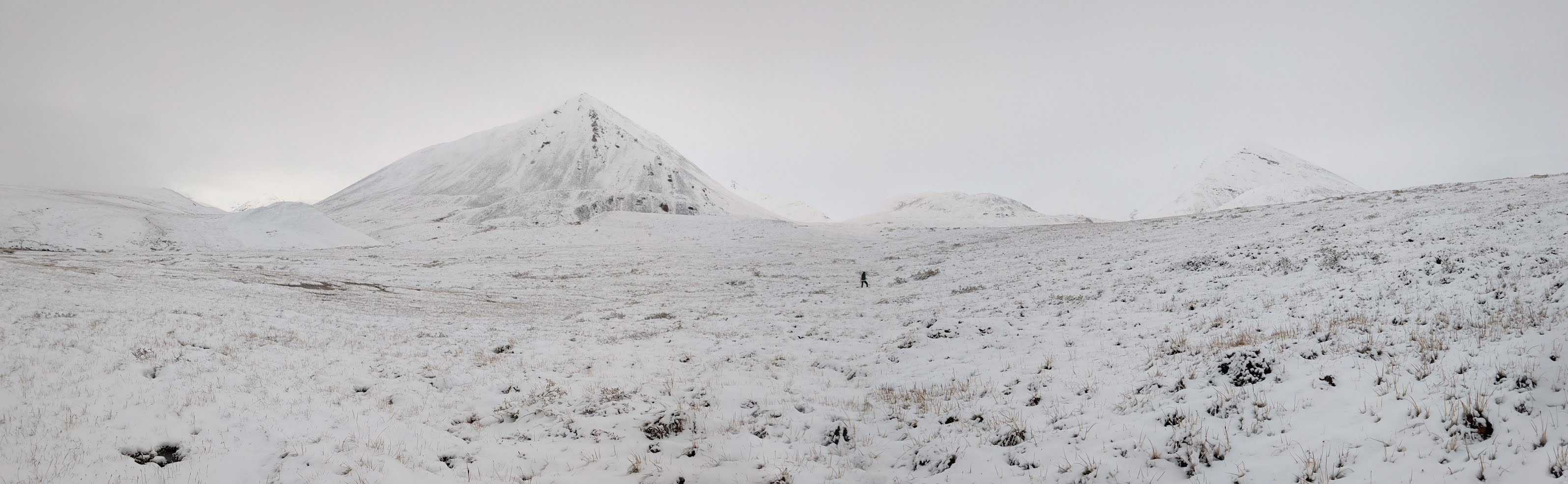
How to Explore Gates of the Arctic – It’s really important to set your expectations about this park properly before attempting to explore it. Unlike many National Parks, which we’ve essentially turned into nature theme parks (Yellowstone), do not expect to ‘spend a few days seeing the top sites in the park.’ Unless you’re in this park for months, you’ll hardly see any of it. This park is about the experience of being isolated in remote wilderness in one of the last true frontiers on earth. It’s not about ‘getting your national park stamp’ and taking selfies at the key viewpoints, or hurrying up the most popular trails to ‘summit’ various peaks. You have to be ready to be happy and satisfied with whatever you do or do not see. If you only see the outskirts of the park (like we did), be happy with that. If you make it 15 miles in, be happy with it. If you make it a few miles, but are stopped by weather or a river that’s abnormally high and have to turn back, accept it for what it is. You have no control here, and no way of knowing what weather the next day will bring (unless you have a satellite phone). So you have to be prepared to accept things for what they are. I found it to be a lot like exploring as a kid. We only hiked 10-13 miles, but we spent lots of time climbing around near rivers, exploring streams, scrambling up walls, and re-routing after a path we were taking came to an insurmountable obstacle. It felt more like ‘play’ than hiking usually does, which was a unique experience.
Cell Service in Gates of the Arctic – There is no cell service. If anything goes wrong from right outside Fairbanks to Prudhoe Bay, you won’t be able to call for help. So, bring an extra tire(s) and an extra gas can, medicine/supplies, and all the food and drinks you need.
Gas near Gates of the Arctic – Outside of Fairbanks, gas is only available in Coldfoot and Prudhoe Bay. The gas station in Coldfoot seems to be open 24 hours and holidays (we were there Labor Day). We did not need to use our extra gas can.
Groceries / Food near Gates of the Arctic – There are no groceries available in Coldfoot. There may be some in Prudhoe Bay, but we didn’t make it there, so I’m not sure. Buy food in Fairbanks before you head out. There is a small café in Coldfoot that has basic food and some candy / snakes for sale. We didn’t eat there because we had lots of our own food.
Booze / Bars near Gates of the Arctic – One of us thinks beer was for sale at the gas station / restaurant, and the other doesn’t think it was for sale. Regardless, the selection was very limited so be sure to BYOB. I suggest some hot toddy mix. It was our staple during our long weekend.
Milepost for Gates of the Arctic – This guide is pretty invaluable for the Dalton. It has mile by mile notes and info, which is critical when you lose service for days at a time and are trying to figure out which areas / pull-offs to check out, or how far you are from something.
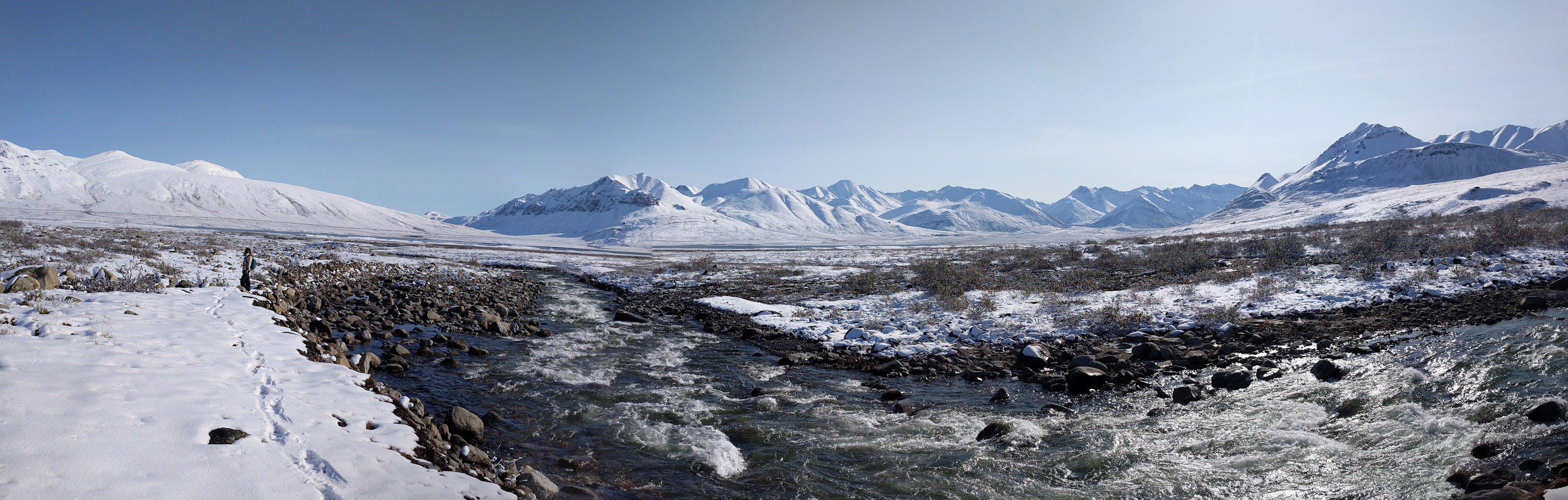
Camping in Gates of the Arctic – There are a number of pull-outs where you can camp (all are discussed in Milepost, but I’ve listed a few here). We stayed at a free BLM campground near Galbraith Lake. It was absolutely pristine. The only sound we heard all day/night was the sound of the river in the distance. You have a perfect surround view of white mountains and tundra (If there’s snow, but I’m sure it’s equally as beautiful without snow). There were vault toilets and fire rings (but don’t expect to gather wood because there isn’t any to gather).
River Crossings in Gates of the Arctic – You do need to cross various rivers of varying speed and depth to make it into the park. There was one close to us that we attempted to cross without getting wet, and ended up giving up on, and following it toward the park instead. This works as well. Just realize that you will need to cross. The best thing to do is take your shoes off and walk across the shallow ones you cross first. I believe some are pretty high and deep, so be ready to turn back, and try not to be too disappointed if you have to turn back before you like… Remember, if you get in trouble out here, no one is coming to find you (or not for a long time at least).
Weather in Gates of the Arctic – Weather is really unpredictable here. It was in the 30s when we were there, and there was a freak blizzard. That seems to be rare for the region since signs said it only gets 20” of precipitation each year (It got 5” while we were there). Allegedly, it’s about as dry as Arizona… August is the rainiest and wettest month, followed by July. Next year, we’re aiming to arrive in June, which is a drier month. It never was much above 30 degrees while we were there (although the sun warmed us tremendously on the second day), but it sometimes reaches 60 degrees. Just be prepared for arctic temperatures and rain. I wore my ski pants and ski gear (because it’s waterproof) most of the time and was really comfortable.
Bears & Wildlife in Gates of the Arctic – The only wildlife we saw was an arctic fox, and a bear on the drive out. However, I would have one bear spray per person, and carry that with you (we only had one with us), just to be safe. Again, if something goes wrong, there’s no help coming for you, and you have a long drive back out, so you need to be well prepared.
Antibiotics / Meds for Gates of the Arctic – Another thing I plan to do next year is get penicillin, cipro, and maybe a steroid to take with us. This way, if anyone gets sick or hurt while hiking, we hopefully can keep the person well enough to make it out of the wilderness and through the long drive back to Fairbanks for medical help. I got a pretty bad case of strep throat the week before we went, which really drove home the need of being prepared for unpredictable, intense sickness. The hiker that Into the Wild is based on died only 20 miles into a trail (he was 20 miles away from a small town outside Denali). He just got so sick that he couldn’t make the hike back, or the river crossing he needed to do. This isn’t to scare everyone because if you’re prepared, you’ll be fine, but you do need to be ready for things that may go wrong. Even common illnesses or injuries can be dangerous when you have a multi-day hike back plus 6-10 hour drive to even make it to help. So, bringing preemptive meds is smart.
Galbraith Lake BLM Campground, Arctic Circle
This is a free BLM campground that lies roughly 100-150 miles above the Arctic Circle, and is flanked by Gates of the Arctic on one side (it’s roughly a 7 mile hike through wilderness to get to the park), and the Arctic National Wildlife Refuge on the other side (it’s a 3ish mile hike away). This is where we stayed when exploring Gates of the Arctic.
Dalton Highway, Fairbanks to Prudhoe Bay (Arctic Circle)
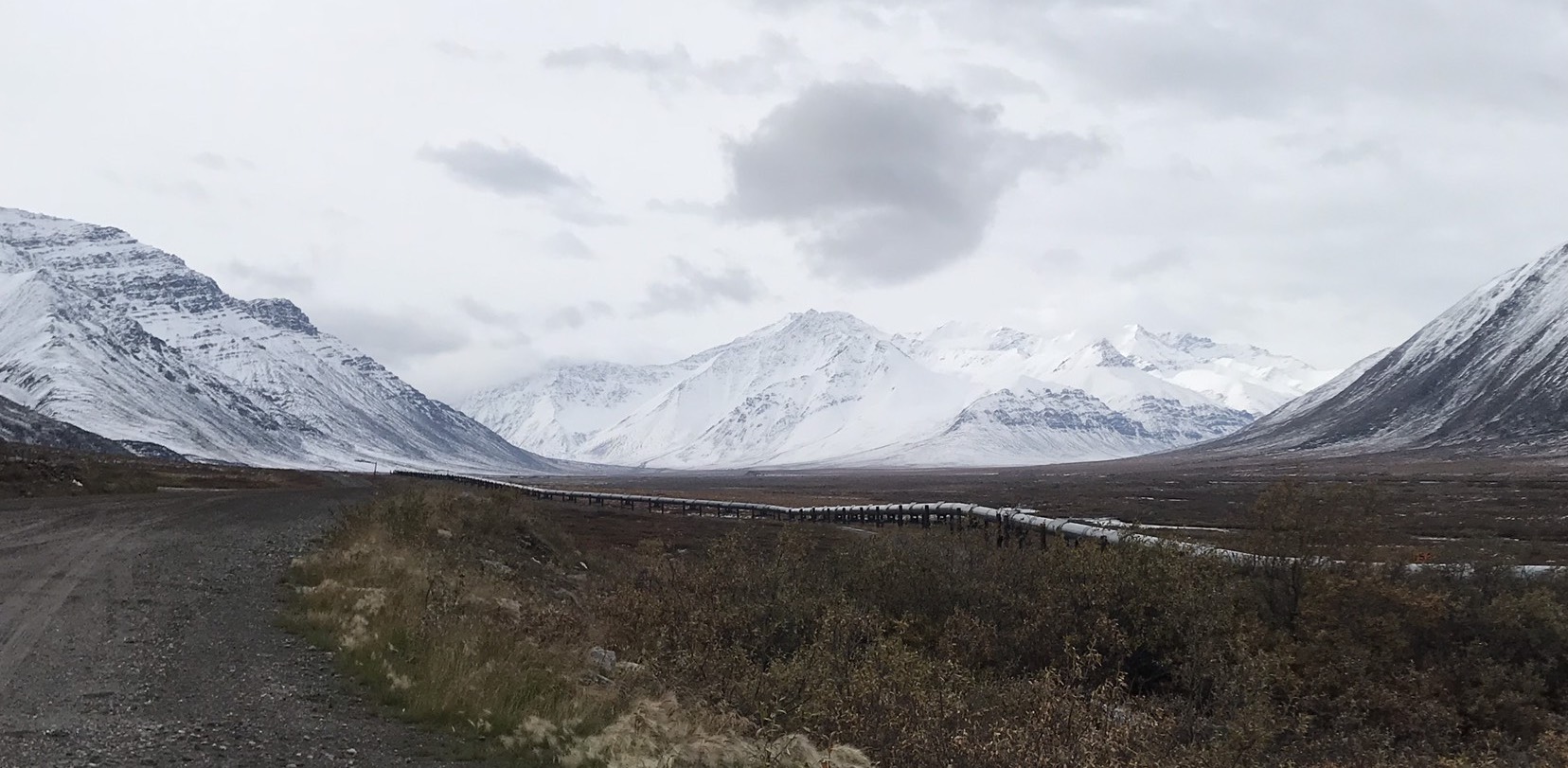
Alaska, British Columbia, and the Yukon are filled with nothing but epic drives and highways. The Dalton Highway stands out because it is the most remote and possibly the most treacherous highway in the US. This is largely due to the fact that the entire 500 or so mile drive is only 25% paved, has no cell service, and only has 2 stops with gas/services, and those stops are 250 miles apart (in Coldfoot, and Prudhoe Bay). If you can stomach the remoteness and potholes, the epic views are well worth any driving risk (in my opinion). Some of the most amazing views we saw were while driving through the Brooks Range over Atigun Pass, the highest mountain pass in Alaska (we happened to drive through the Brooks during a freak August snowstorm). You get to see the transition from tree line to Arctic tundra on the drive, and take photos by the sign announcing when you’ve crossed the 66 degree north latitude line, better known as the Arctic Circle.
Preparedness for Dalton Highway – I didn’t feel that the Dalton was quite as treacherous as it was made out to be. That said, you absolutely need a spare tire (or two), and a spare can of gas. The road is 75% gravel; 25% paved, but the dirt / gravel is hard and pretty nice to drive on. We were able to go 60 mph most of the time, so the trips took less time that Google and Milepost estimated. If anything does go wrong, there are a bunch of truckers on the highway, along with some tourists, so you most likely can flag someone down to help you, if needed. You also should bring your own food and water to last you however long you’re staying in the Arctic.
Cell Service on Dalton Highway – None outside of Fairbanks.
Gas & Other Services on Dalton Highway – You can get gas, a basic meal, some snacks, possibly some beer, and a place to stay in Coldfoot. The only other stop with services is Prudhoe Bay, which is at the end of the Dalton on the Arctic Ocean. We almost went to Prudhoe to check out the Arctic Ocean, but fortunately the weather and a more thorough look at Milepost helped us decide otherwise. Prudhoe Bay is a small oil town. Although we haven’t been there, it seems to be a lot like Coldfoot, except the gorgeous mountain scenery is replaced by oil rigs. You cannot drive out to or see the Arctic Ocean without booking a tour, which seems to be run by the oil company and needs booked 24 hours in advance. There are customs-like border patrols that block you from the ocean unless you’re on the tour bus. My understanding is that the tour of the Arctic is essentially a tour of the oil field, so don’t expect to see lots of icebergs covered in penguins and polar bears. Expect industrial scenery and an explanation of how the pipeline is powered. You can take a ‘polar plunge’ in the Arctic and get a t-shirt (LOL). I’ve taken so many polar plunges in an attempt to get a crude shower, that getting a tourist shirt for one that I took in an oil field seemed to debase the experience.
Pipeline on Dalton Highway – The Dalton follows the Trans-Alaskan Oil pipeline. Milepost has a lot of info on it and tells you where you get especially good views. This wasn’t something we cared about, but, if it’s your thing, then you’ll like this drive even more.
Milepost for Dalton Highway – The Milepost is a great guide to Alaska, but it was more useful than ever for the Dalton. It provides milepost-by-milepost information for the whole highway, and is considered the ‘bible’ of the north. Since you won’t have service or anyone to ask, I’d suggest picking up a copy before tackling the Dalton.
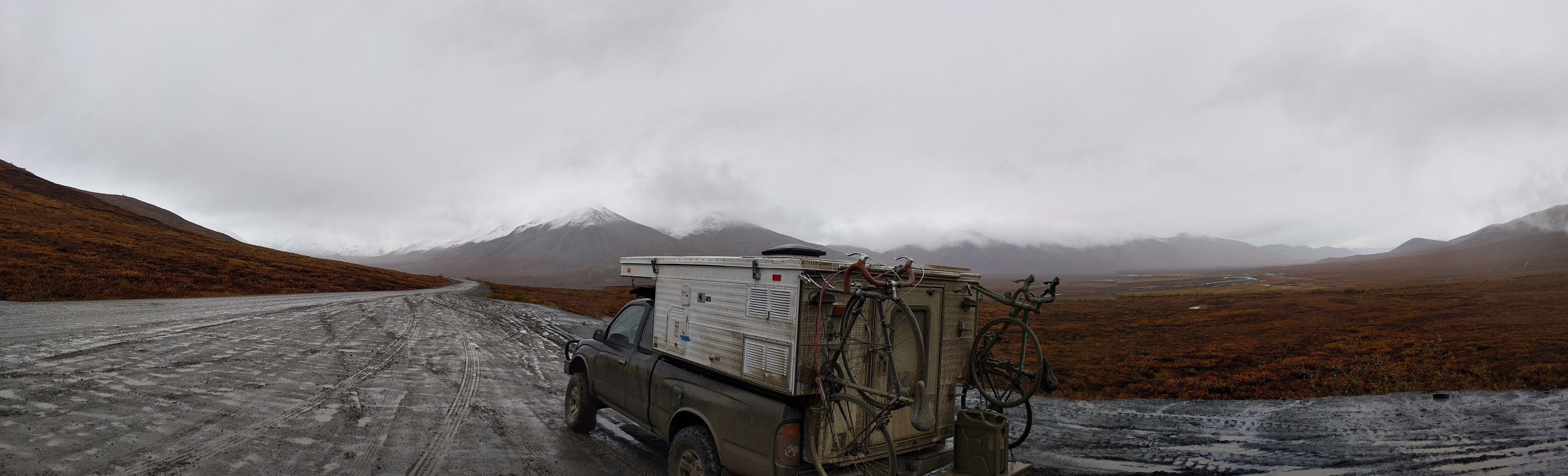
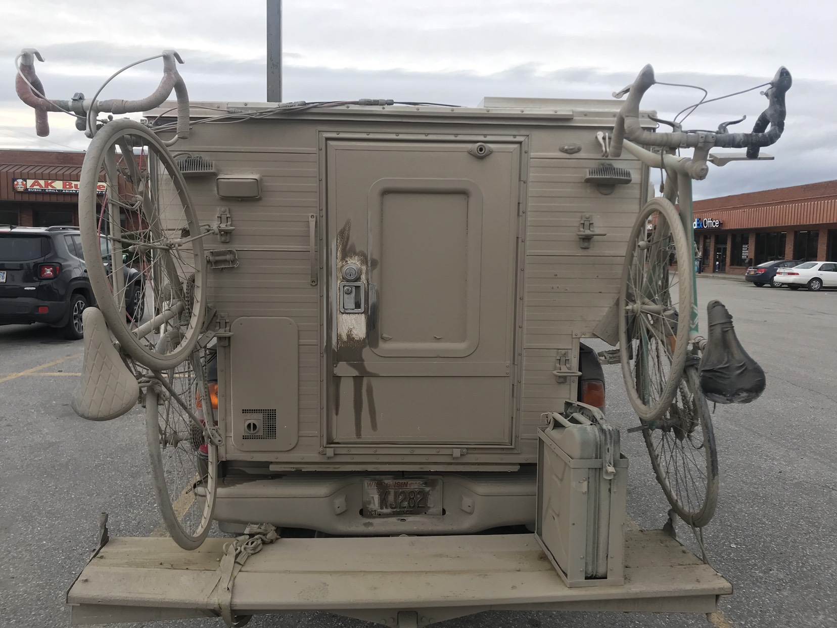
Gettin Down & Dirty on Dalton Highway – This is a random note, but expect your vehicle to be covered in a thick layer of mud (if it’s wet), or dust (if it’s dry). Check out the photo below of our tramper after driving the Dalton.
Denali National Park, Alaska
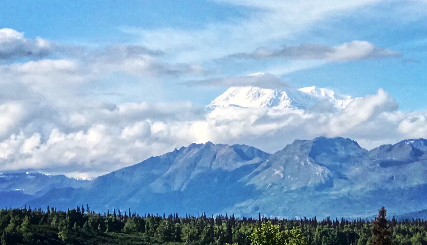
Denali is a really cool park. We weren’t able to spend much time there due to weather (rain) and time restrictions, but we plan to head back next year so we can do it more justice. We only got one good view of McKinley (AKA Denali) during our time there, but it was actually more impressive than I imagined. It looks absurdly high, especially since you can actually see most of it, from base to summit. If you’re lucky enough to get a view of it, hang out and watch it for 30 minutes (or however long you have until it’s no longer visible). Don’t expect to get a view again, or get a view further down the road / trail. It also is really fun to watch its weather patterns change. We read that it has three competing weather patterns that battle it out near its summit. You can watch this happen, and watch glaciers slide down its face if you hang out and have a view for long enough.
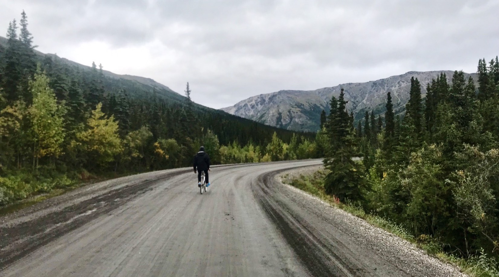
Biking the park road was really neat. We did it with a couple older, beaten up road bikes and they made it just fine. I’d suggest getting out of the tour bus and hiking or biking around the park. It’s not as remote as Gates of the Arctic, but it’s the most remote place most people will see, and I firmly believe it’s worth getting out of your comfort zone and actually immersing yourself in nature. If you’re prepared, you’ll be fine, despite whatever your grandparents or friends from home may say.
Driving Denali National Park – There’s a road that goes pretty far into the park. You can only drive 15 miles on this road. To go beyond the 15 mile mark, you have to either hike on foot, bike, have bought a shuttle / tour bus ticket, or have paid to camp at one of the campgrounds. If you book one of the campgrounds, you get to drive 15 more miles into the park, and stay within its bounds.
Bus / Shuttles in Denali – Since you can’t drive the park, most people opt for a shuttle or tour bus. The shuttle bus is $40 per person (the tour bus is a bit more expensive). If you take the bus, expect a very long day (unless you’re backpacking and staying overnight). If you ride the bus as far as it goes, it’s an 11 hour ride. A few rangers suggested that we take the bus to the Eielson Visitor Center, which is a 4 hour ride each way. This is the main area within the park where you get views of McKinley (Denali). You can’t see it from everywhere (I’ll elaborate further below). You can ask the bus driver to stop and let you off wherever you want and go hike or bike around, however this is the only area where you have a real chance of seeing the monster mountain. Again, we opted to simply bike the road as far as we could since we had no chance of seeing McKinley regardless, so I can’t vouch for the bus experience.
Hiking Denali – There are a few hiking trails near the entrance of the park, however the rest of the park is trail-less (like Gates of the Arctic). What’s cool about this is, you can simply choose a ridge or area, ask the bus driver to stop, hop off and go hike that area, then catch a bus back when you’re done (or camp overnight).
Showers / Laundry / Food / Beer in Denali – There’s a cool spot right as you enter the park that has everything you could need. There are paid showers (I think they were around $5 per person, but can’t remember exactly). There also is paid laundry (both showers and laundry close at 8:30pm). There’s wifi, food, and 6-packs of good beer for purchase at this cabin as well. This store / mini resort is the first giant log cabin you come to after entering the park, before coming upon the Visitor Center.
Camping near Denali – There are a number of paid camping options both in and around the park, including the South and North viewpoints (the South viewpoint is in Denali State Park, while the northern viewpoint is in Denali National Park. The parks are connected to one another).
Free Camping near Denali – Free camping was really easy around Denali. We followed parks road and found a rest stop with free camping that we stayed and worked at for a day or so. We also found a good number of pull-offs and BLM land that we could stay on.
Cell Service near Denali – There’s no cell service in Denali, but cell service surrounding it was really good.
Bars / Breweries near Denali – 49th State Brewing is right outside Denali. It’s a super cool-looking spot with a great vibe. Unfortunately we weren’t too impressed with the beer, but it’s worth checking out. It has a replica of the Into the Wild bus (the hiker died on a trail that starts relatively close to where the brewery is located). We stopped at Denali Brewing outside Talkeetna as well. It was a really fun spot to taste beer, and had some pretty good brews. It’s definitely worth checking out.
Denali Highway – We didn’t have time to take this road this year, but we plan to do it next year. I read that this is the original Denali Highway that existed prior to Parks Road, which is the main highway now. It’s supposed to be a stunningly beautiful drive that takes you the same general direction as the Alaskan Highway (however it adds 4 or so hours onto the drive). If you have extra time, check it out!
How to See Denali – In the summer, Denali is only visible 30-40% of the time, so set your expectations properly so you aren’t disappointed… There’s a good chance you won’t see it if you’re only there for a few days. We only got one view that lasted 20 or so minutes. One of the best places to catch views is Denali State Park near the southeastern corner of the park. You also can see it from the Eielson Visitor Center, as I noted above. We’ve heard that, on a clear day, you can see it from Talkeetna’s Riverfront Park, and the drive from Fairbanks to Denali.
Weather near Denali – We had bad weather luck in Denali. It rained and was cold (low 40s) the whole time we were there (we arrived in late August). Denali tends to be a bit cool, so expect colder temperatures even in summer. To maximize your chancers of avoiding ran (and seeing McKinley) I’d suggest arriving in May / June, or going to Denali in winter. Visibility is supposed to be much better in winter.
Girdwood Brewing, Girdwood, Alaska
Girdwood Brewing was my favorite brewery in Alaska, and one of my favorites of the trip. It had two amazing New England (hazy) IPAs (the juicy one was particularly delicious), and really cool merchandise. We hung out there a couple of nights.
Double Musky Inn, Girdwood, Alaska
In case you couldn’t tell, we aren’t really foodies (since we list tons of breweries, but no restaurants in our posts). We try to cook our own food as much as possible to save money. We decided to splurge one night since we’d heard that Double Musky was one of the best restaurants in all of Alaska (foodies be warned – Alaska is not known for its epic food scene). We shared two appetizers and a pasta. It was truly phenomenal food that rivaled the best restaurants in Chicago. The atmosphere is great too. Highly recommend checking it out.
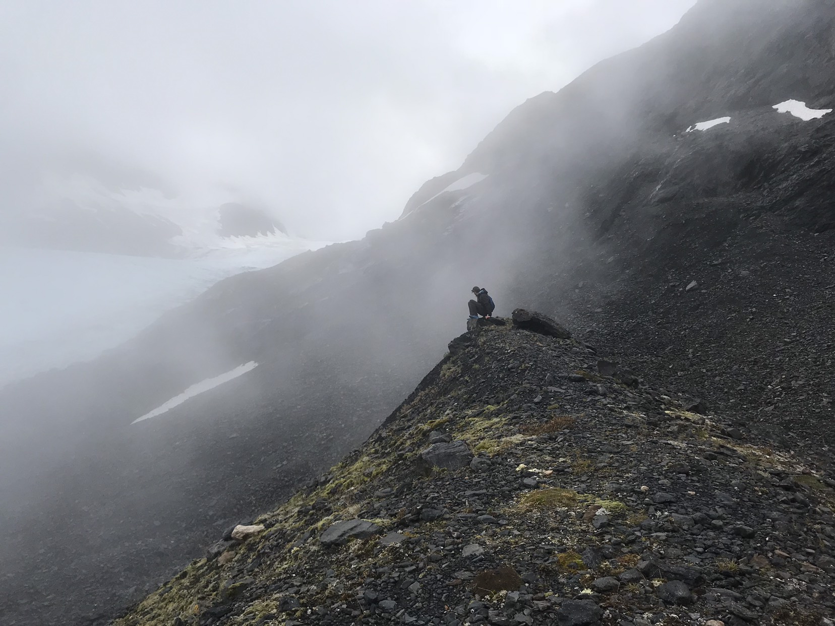
Slaughter Gulch Trail near Cooper’s Landing, Alaska
This is an awesome trail. It felt exactly like I’d imagine hiking in Hawaii would (other than I assume it would be much warmer in Hawaii). It’s a roughly 5 mile trail straight up a small dirt path with lots of little scrambles that keeps you hanging off the sides of lush green mountains overlooking a bright blue lake / river. Very rainforest-like. Tons of wild blueberries, and hallucinogenic mushrooms along the path. One of my favorite trails I’ve ever hiked because it was a good workout, but not an excessive time commitment. Plus you get to the top quickly, then can walk around this large ridge for awhile if you want to extend the hike. Unfortunately, it monsooned at the top, so we didn’t get great photos, and I ended up in full ski gear headed back down. Womp! Our photos didn’t do the scenery justice due to the weather, so I stole some from Google so you can see how it looks in better weather. Note that August tends to be a cool, (40s or low 50s Fahrenheit) and rainy month in Alaska. To avoid the rain, you should try to arrive a bit earlier in the summer.
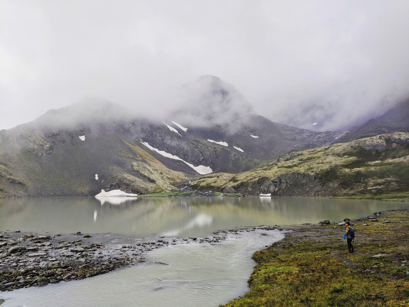
Crow Pass Trail near Girdwood, Alaska
This is unquestionably one of my favorites, if not my favorite, hike of the trip so far. Considered to be one of the best hikes in the Chugach Mountains, the trail follows a portion of the Iditarod Trail. If you hike the whole trail, it’s 21 miles long. We just hiked a portion, which took us past a glacier, waterfalls, wildflowers, ruins, and edible berries. It’s challenging, but not all that difficult, so it’s easy to enjoy the hike as opposed just power through trying not to pass out. I can’t recommend this one enough. The photos below will tell you why.
Soldotna, Alaska
We heard great things about Soldotna, but weren’t able to spend much time here. However, I’d be remiss if I didn’t call out a few great spots:
- The Moose is Loose – This is supposed to be a phenomenal bakery. It was closed both days we were in Soldotna, so we didn’t get to try it, however I’d recommend checking it out if you’ can.
- Fred Meyers – This is a dirtbag / traveler haven. It allows you to camp for free, plus has free RV water filling, a dump station, and propane. Also, there’s a short walking trail through the woods from its parking lot to St. Elias Brewing Co. Really awesome that they do this.
- Elias Brewing Company – This is a cool brewery that’s made even better since it’s walking distance from Fred Meyers’ free overnight parking lot. I don’t think we were particularly impressed with the beer, but I remember thinking it was generally good.
Kachemak Bay State Park, Homer, Alaska
We spent one day hiking in Kachemak State Park. We saw sea lots of sea otters floating on their backs on the way across. Hiked Glacier Spit trail to Grewingk Glacier. Really nice trail, but very flat and easy. Only about 4 miles long. Glacier lake was pretty with lots of blue icebergs. Hiked out to the sea and tried to go back up a Ridge Trail, but immediately ran into a big black bear eating berries. It wasn’t afraid of us and wasn’t moving away from the trail, so we went back after waiting 20-30 mins. This island foliage was very tropical. Made you feel a bit like you were hiking in Hawaii. The boat ride was $80 each. Overall, I’d say this was a worthwhile day trip. I’d suggest you spend a few days camping or staying on the island if you have more than a few days to spend in Homer.
 Homer, Alaska

Homer is an excellent place to spend a week or so in Alaska (as everyone said it would be). It lies on the coast just below Seward. One of its most memorable and striking features is the Spit, which is a very narrow strip of land that extends out into the bay toward Kachemak Bay State Park. The Strip is touristy, but it’s a cool location. There are bunch of shops, a couple of typical, tourist area bars (one that’s covered in $1 bills), and vendors that ferry you across the bay to the state park. There are a number of bars and breweries to check out, and miles upon miles of shoreline to walk that’s filled with tidal pools and surrounded by views of the mountains and massive glaciers in Kachemak. It rained a lot while we were there, but it overall was a really great week.


Free Camping in Homer – It’s tough to find free camping near Homer. We paid for camping on the Spit the first few nights, then received a local tip that we could boondock on Bishop Beach if we had 4WD. To make this work, you have to drive out onto the beach from the parking lot, and then go as far right as you can (be cognizant of the tide line. It can vary 500 or more feet between high and low tides at spots around Homer. Be sure not to park where the tide will come up past your vehicle while you’re sleeping…). Technically, you aren’t allowed to camp here, but you can probably do it without being kicked out as long as you’re stealthy about it.
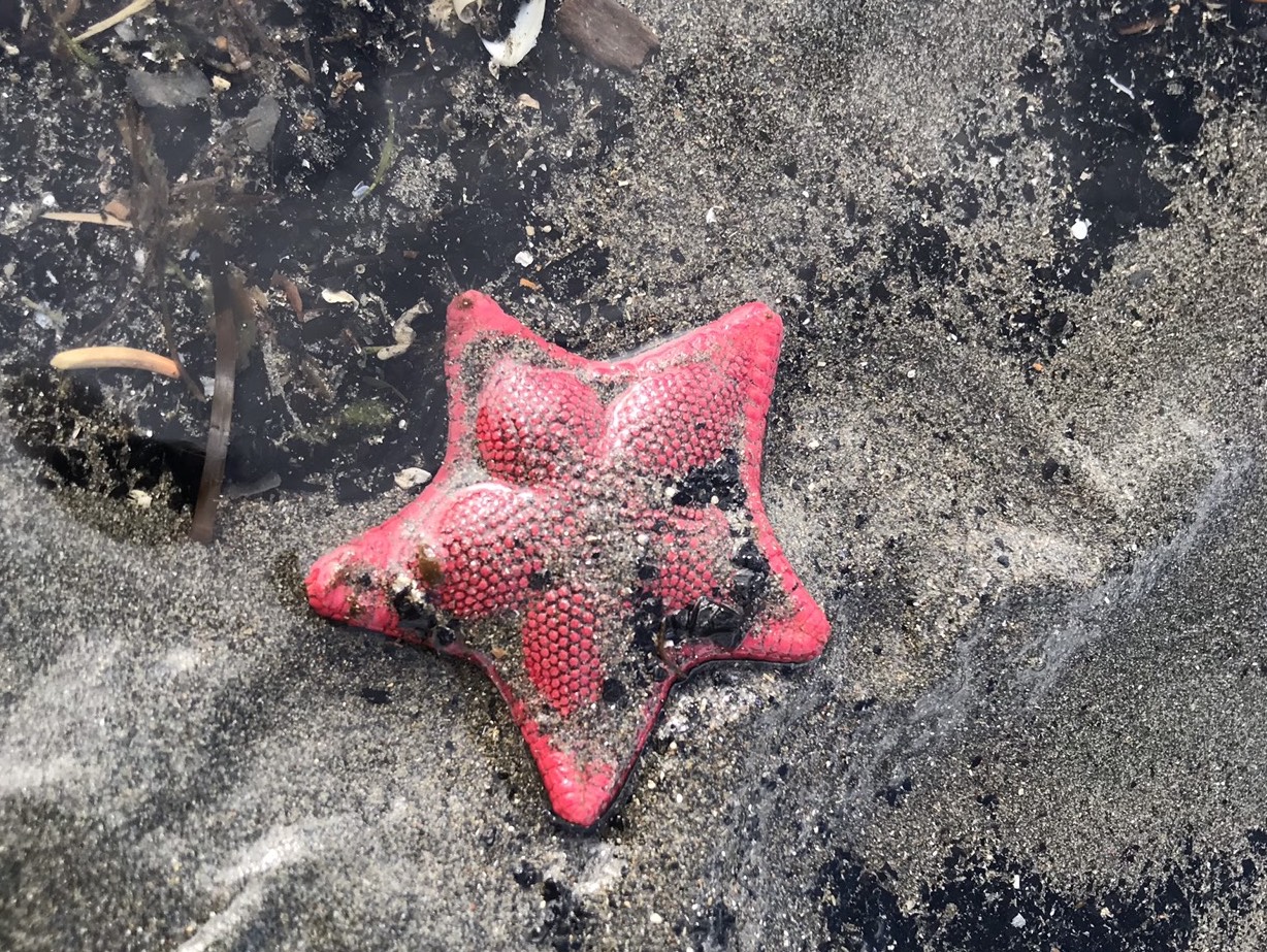
Paid Camping in Homer – There are a number of paid campgrounds on the Spit. We stayed at Mariners Park for $15/night for the first few nights. It’s right on the beach. You can walk or run the 4 miles down the beach to the end of the Spit at low tide (you could probably walk the other direction and make it all the way to Bishop’s Beach if you wanted to). The tide varies by 100s of feet between high and low each day, which is pretty cool to watch. I’d highly suggest checking out the tidal pools at low tide. I found one bright red, little, perfectly shaped sea star… It was so perfect that it looked like a toy (see photo above).
Hiking in Homer – In my opinion, the best hiking is along the beaches or across the bay in Kachemak State Park. Next time, we’d spend a few days camping or staying across the bay in the park. Surprisingly, there’s even a little town in one part of the park, and there is some cell service. We wish we would have realized that earlier, and spent a few days exploring and working in the park.
Breweries in Homer – We checked out both breweries – Grace Ridge & Homer Brewing. Worked at Homer Brewing for a day. Bought shirts and stickers. We preferred its beers to Grace Ridge.
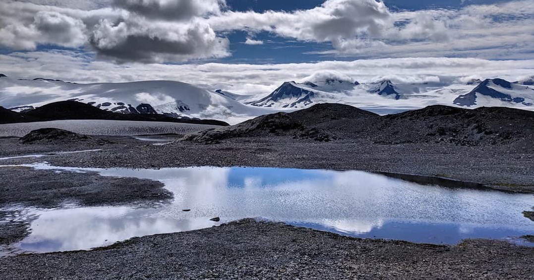
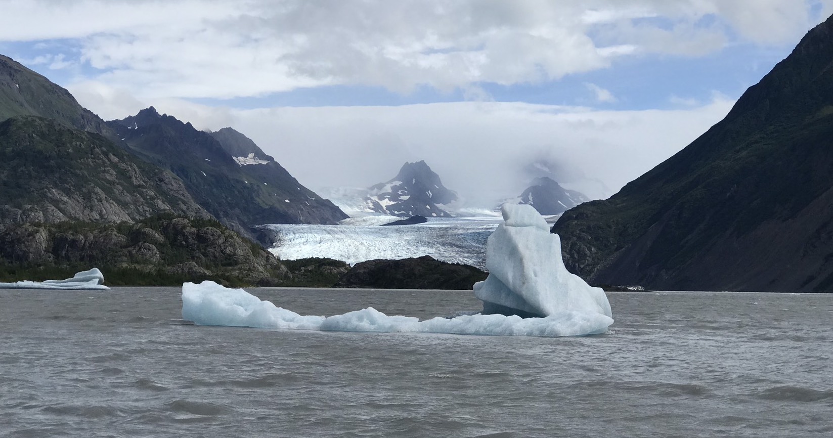
Kenai National Park, Seward, Alaska
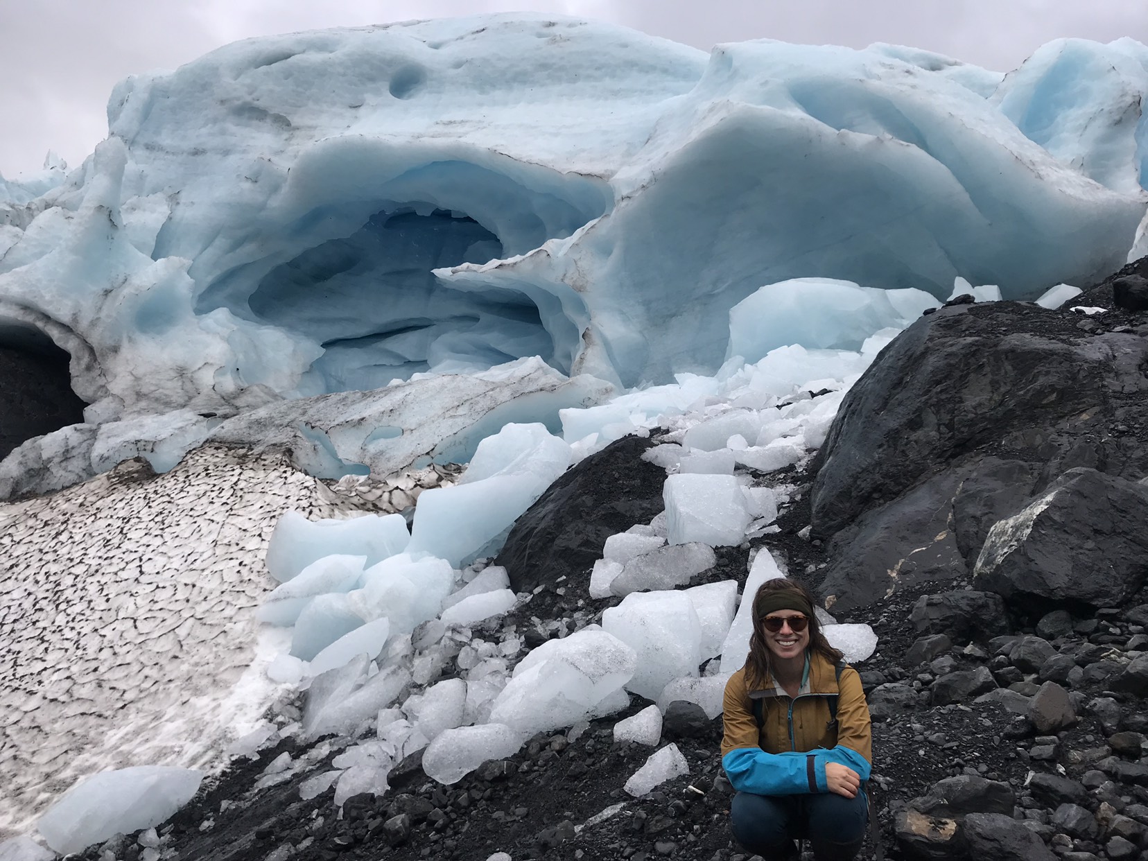
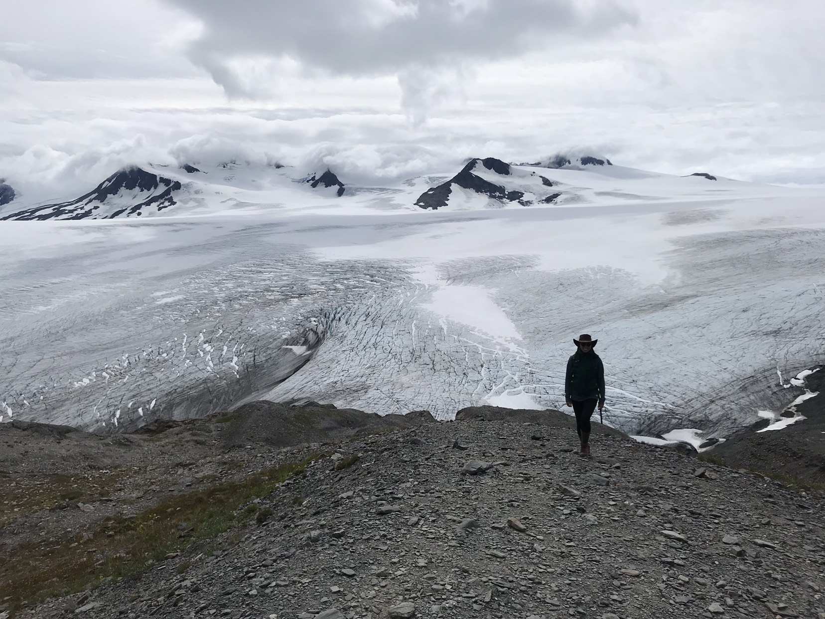
Kenai National Park is right outside Seward. We checked out Exit Glacier on our first day. It’s a very easy hike filled with tourists, but a cool place to see. Our favorite hike (and one of our favorite hikes of the trip) was the Harding Ice Field hike. Felt very dreamlike. Seemed a bit like the Scottish Highlands and/or New Zealand. It’s the 4th largest ice field in North America, and consists of lots of glaciers strung together.
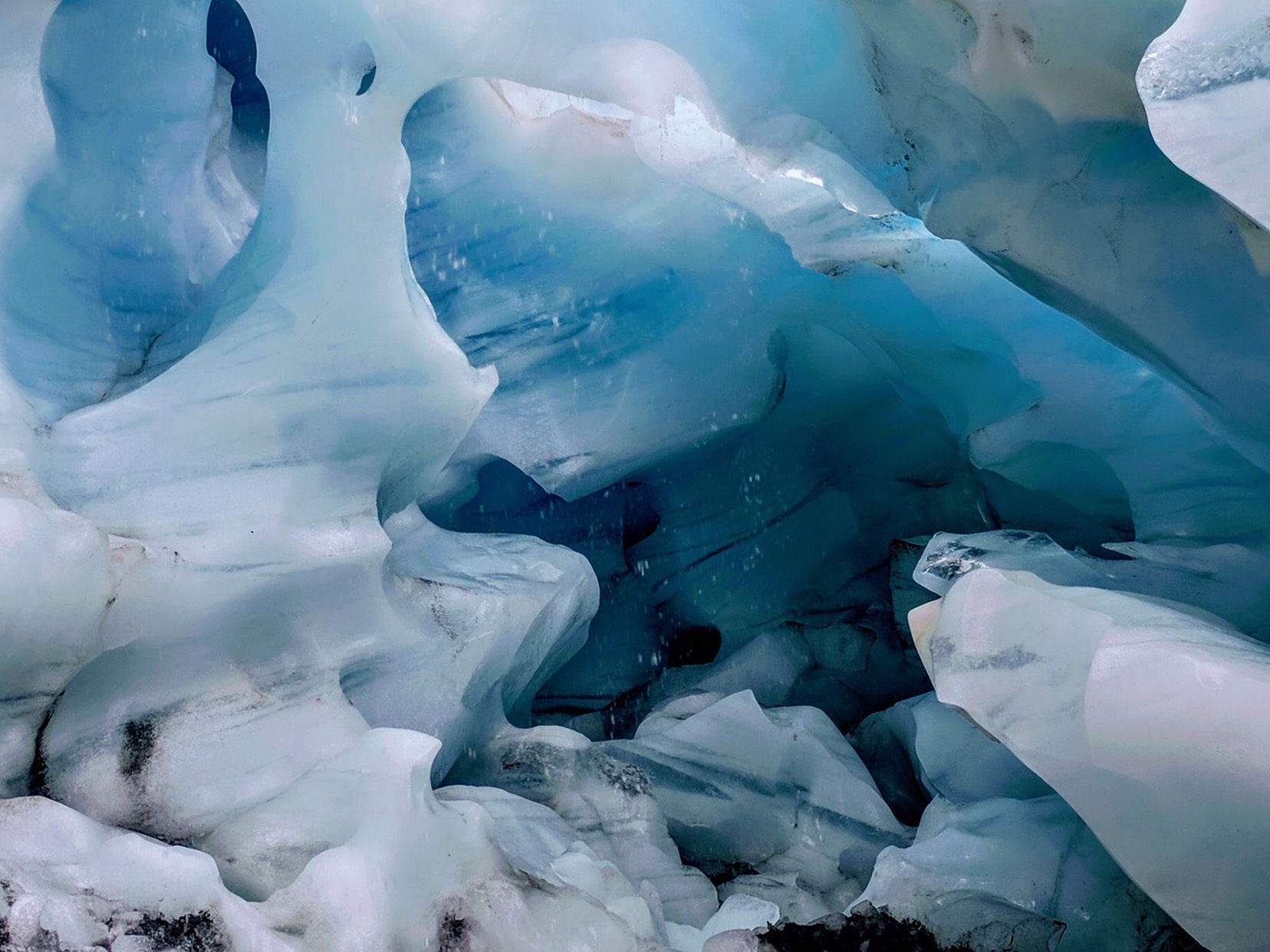
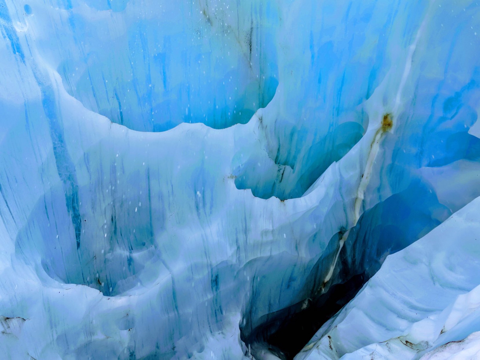
If you can only do one thing here, do the Harding Ice Field hike. Exit Glacier is cool, but it’s an overly easy hike and crowded. The Exit Glacier area, which includes the Harding Ice Field hike, are the only areas accessible by vehicle, so you’ll need to backpack in to go further. If you do the Harding Ice Field Hike, be sure to find the tiny route leading off what appears to be the end of the trail overlooking the ice field. You can scramble all the way down into the ice field and explore it at your leisure. We found a massive ice cavern if you head to the right once you hit the ice field.
Seward, Alaska
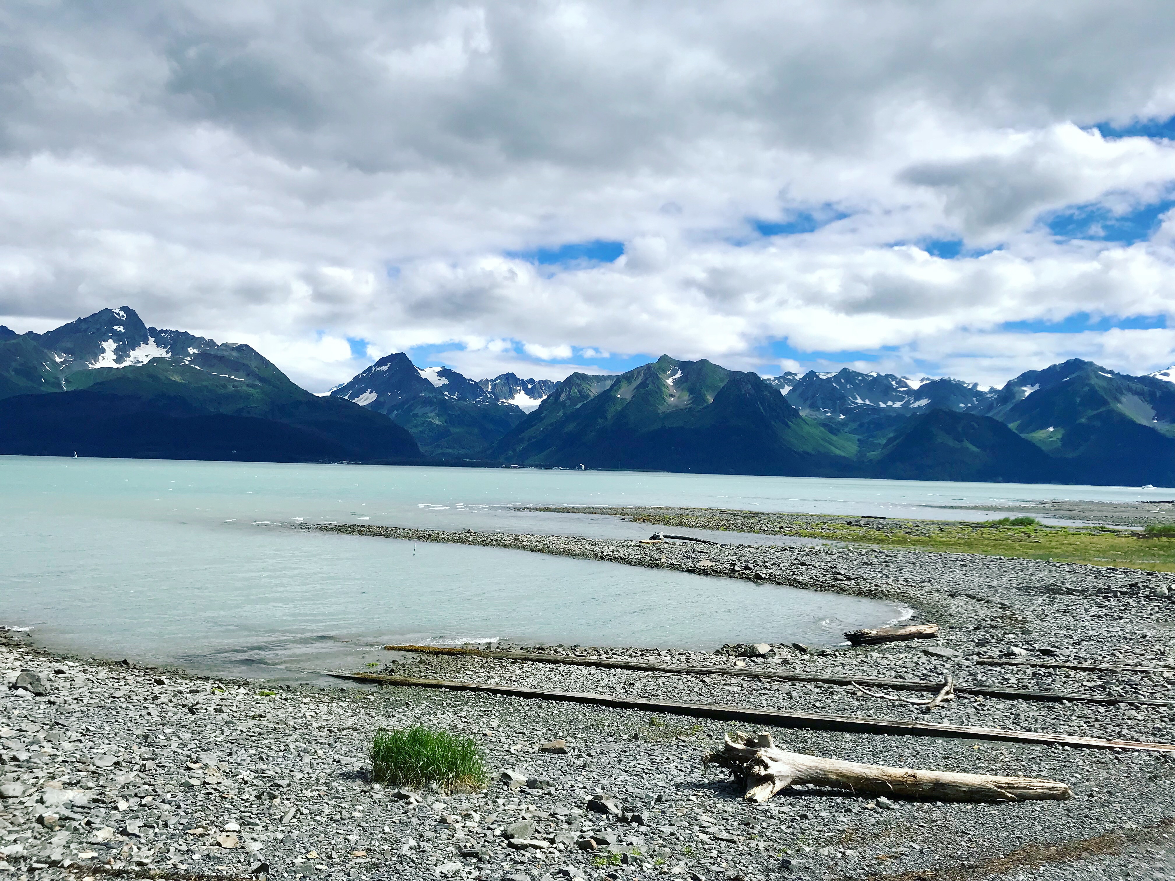
We liked Seward so much that it’s one of the few places we’re going back to again next year. We both agreed we could live here (for the warmer months, at least). It’s a great mix of gorgeous hikes and parks, fantastic kayaking, and a good bar / nightlife scene when you need a break from physical activity. The water is so blue, and the flora / fauna so vibrant that it gives off a tropical vibe.

Free Camping in Seward – We boondocked on the road into Kenai National Park (near a river bed) for the first few days. We had perfect cell service, and it was a beautiful area to walk around in.
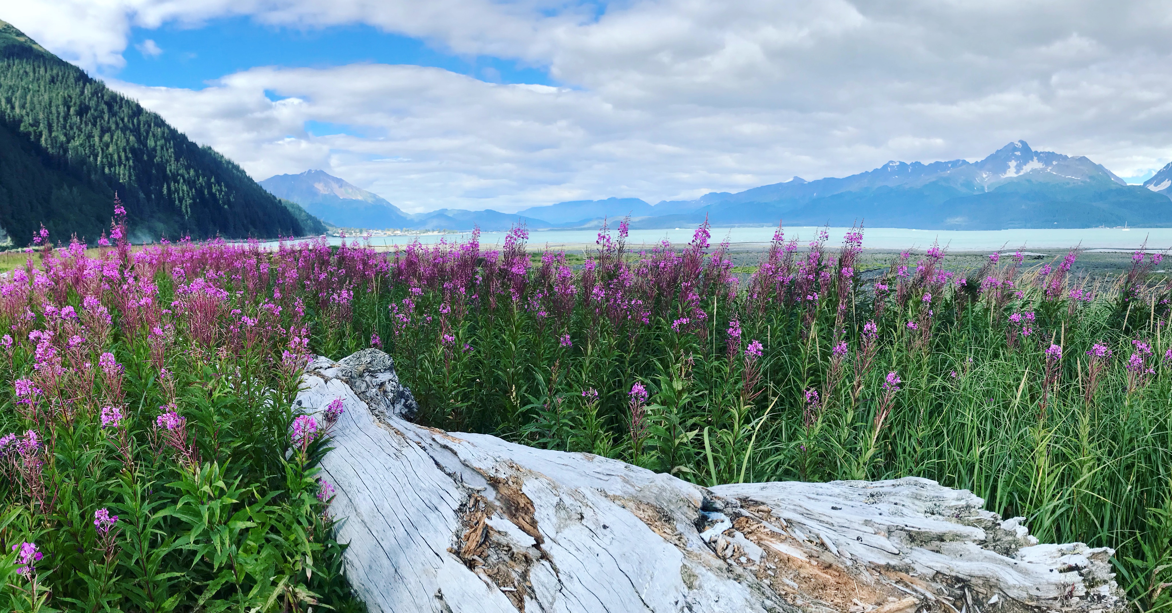
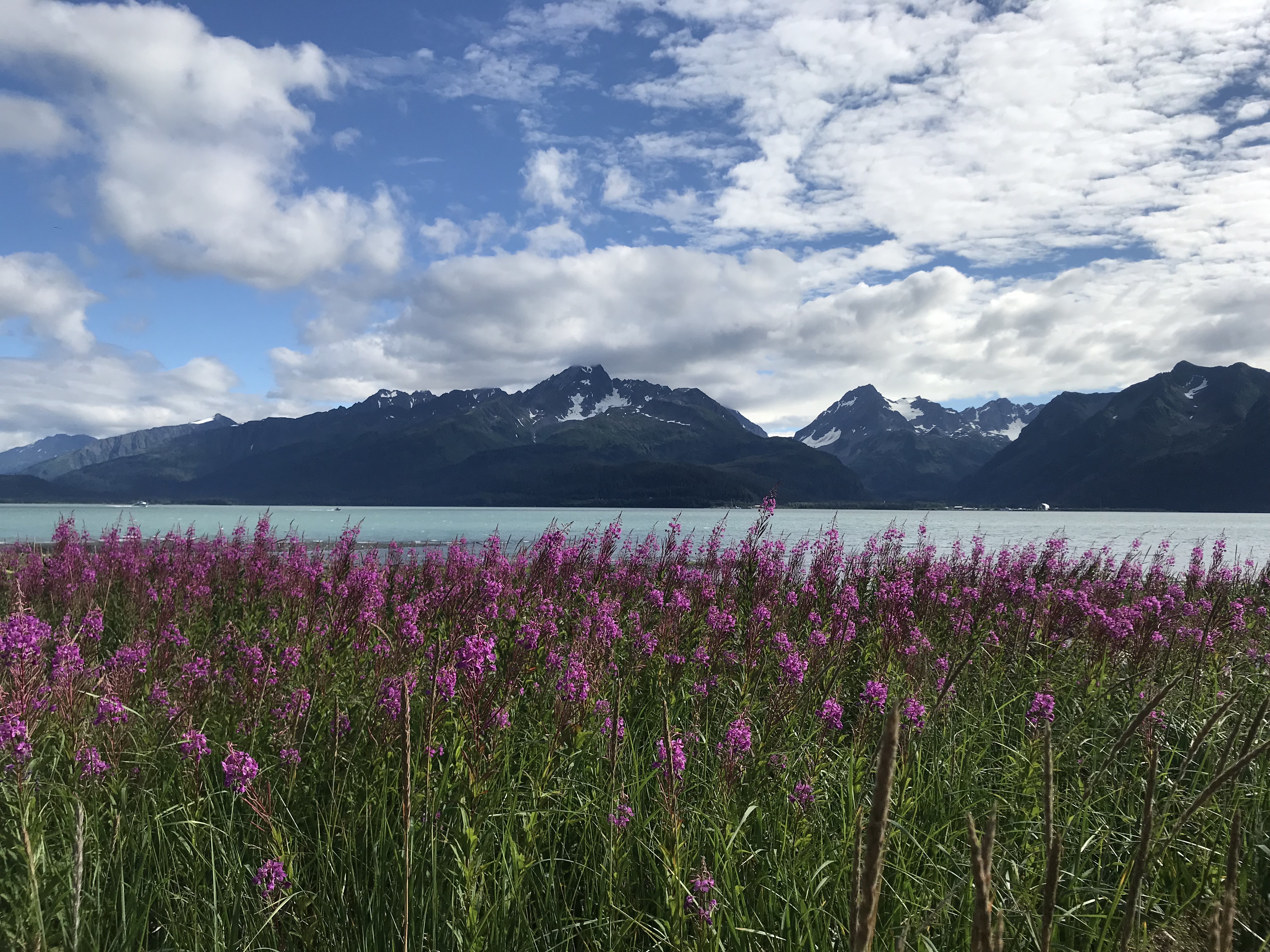
Paid Camping in Seward – We met up with a friend at Miller’s Landing. If you can deal with $27/night, it’s a great place to stay. We shared our friend’s pre-paid spot. Many of the photos of the beautiful bay surrounded by mountains and hot pink fireweed flowers are from this campground. It’s well worth checking out, however you can hang out at Miller’s Landing during the day, pay for a shower, pay for laundry, and then drive somewhere else to camp. That’s what I’d do if I had to pay…
Kayaking in Seward – We did a sunset ‘happy hour’ kayak in the bay around Miller’s Landing (as in we brought beers with us to drink while we floated around). It was astoundingly beautiful. Highly suggest kayaking here if you have your own kayak. You can drive right up to the sea and put it in pretty easily, whether you’re camping there or not.
Hiking in Seward – I highly suggest checking out Kenai National Park since it’s such an easy drive from Seward.
Bars / Breweries in Seward – There are a number of cool bars and breweries in Seward. Some of my favorites were: Seward Brewing – Breathtaking views from floor-to-ceiling second floor windows, and the brewery is covered in vintage snowboards. Unfortunately, I wasn’t impressed by the beer, but the ambiance was amazing (the last photo above is from this brewery). Yukon Bar – This was an awesome spot with great local music on certain nights; Mexican food stand outside the brewery – This opens up after 9pm and has pretty incredible Mexican food. Definitely grab a late night bite here.
Moose’s Tooth Pizza & Brewery, Anchorage, Alaska
This was a cool spot. Great pizza and pretty good beer. Patrick bought a hat that he loves and everyone comments on. If you’re in Anchorage, be sure to check this place out. It reminded us a bit of Piece Pizza in Chicago.
Alaska Rock Gym, Anchorage, Alaska
This gym was great! It had a lot of fun bouldering routes and really nice restrooms / showers. We worked, climbed, and cleaned our nasty selves here before heading further south. The climbing gym is also right beside the brewery mentioned above, and owned by the same person, so you can spend a day hitting up both!
Glenn Highway / Matanuska State Recreation Area, Alaska
You take the Glenn Highway to travel between Anchorage, Seward, and Valdez. We drove it somewhat quickly without stopping much. However, it was breathtakingly gorgeous. We stopped briefly at Matanuska Glacier. It was pretty, but privately owned so it cost $30/person to hike to it. We didn’t pay. Kept driving to this state recreational area instead. We took a few photos of the glacier there and did a quick hike. If you’re on the Glenn, I highly recommend stopping here instead of paying to hike on the private land around the glacier. You can camp here for $20/night in the campground, or $10/night in the parking lot if you want a toilet and to be around more people. However, there are tons of pull-offs where you can camp for free on the Glenn, so I (personally) would just do that.
Haines, Alaska
We’ve heard many people call Haines a ‘little slice of paradise.’ We were so enamored by it when we first arrived that we started looking at plots of land on the second day. It reminded me a bit of St. John’s – Stunningly blue water that looks about as gorgeous as the Caribbean surrounded by lush, green, snow-capped mountains covered in a rainforest (a lot of southeastern Alaska is a temperate rainforest). The weather was perfect while we were there too – sunny and 70s every day. Absolutely gorgeous. One of the prettiest places we saw.
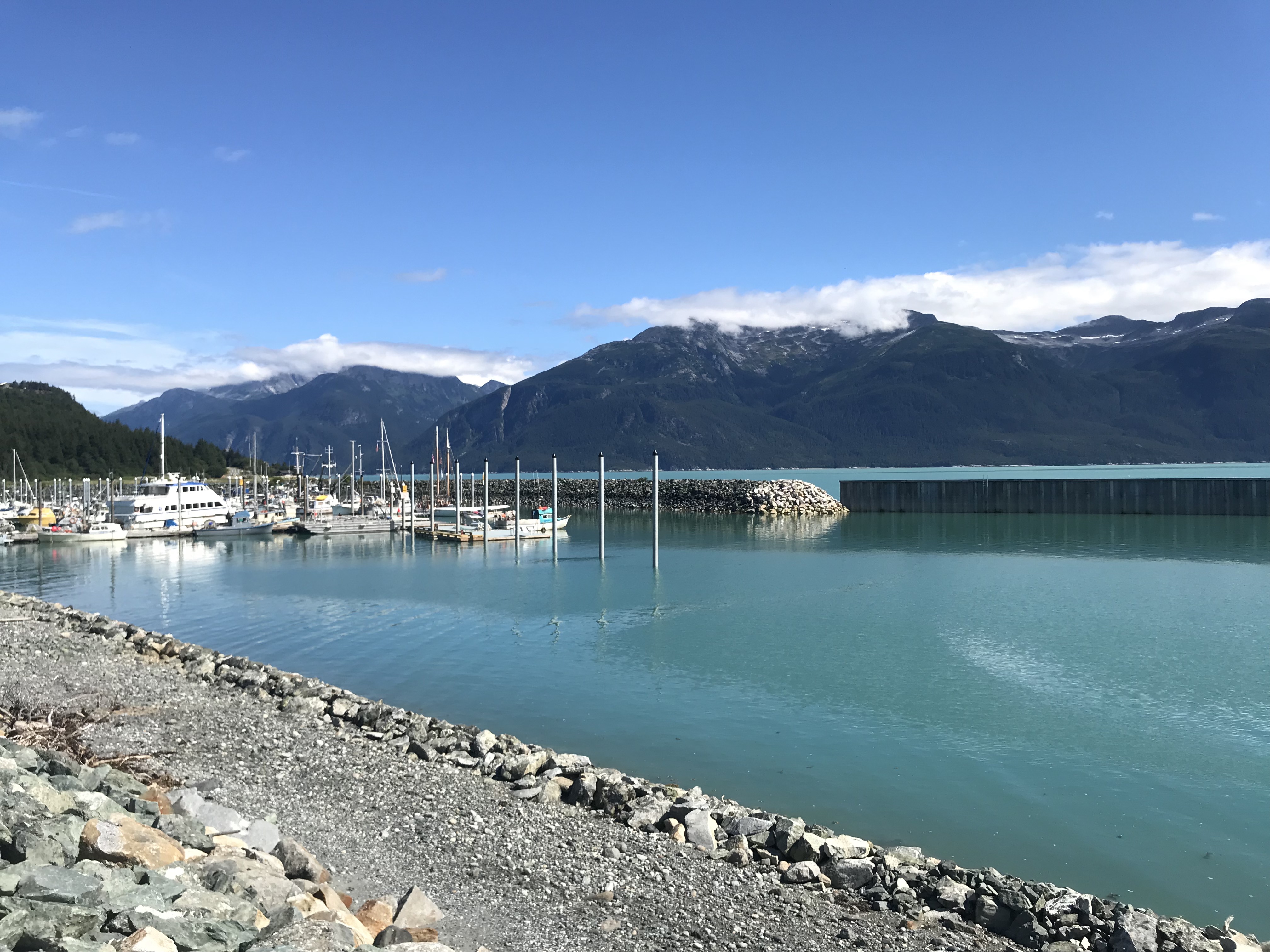
SEAK – Haines hosts the Southeast Alaskan State Fair in late July. We were there during it, and it was a really interesting experience. Camping was allowed everywhere. People had put up tents all over the town and were partying all day and night. A beach near the dock and a park in the town had turned into makeshift campgrounds. We stayed in a marina right on the water for free. If you can get to Haines during the fair, it’s a pretty wild experience. The fair itself looked like an old west town. It was very small and didn’t involve ‘showing’ animals. Instead, it focused on a bunch of cool competitions, such as: Axe throwing, logging, fisherman, DIY fashion show, 5K obstacle course, etc. There were also many drink tents and makeshift bars set up, which is very Alaskan.
Bars / Breweries in Haines – We checked out Haines Brewing. It was OK; not one of my favorites. Some of the bars in town were fun, but people were getting hammered for the fair, so people were pretty toasted early in the evening.
Hiking in Haines – We ran out of time to hike (We focused on the fair and bar hopping instead, lol). There were a number of amazing-looking hikes along the shorelines, though, that I really wish we were able to do.
Driving in Haines – You can drive out of Haines to the main part of Alaska. You have to drive back out into the Yukon, follow along the side of Kluane National Park on the Alaskan or Alcan Highway, and then cross back into Alaska at the Alcan Border near Tok.
Mendenhall Glacier, Juneau, Alaska
The Mendenhall Glacier hike was pretty awesome. Although it’s not thought of as one of the most epic hikes in Alaska, it’s unique because you spend the first part of the hike in the temperate rainforest, and the second half on a cold, barren, windy, frozen glacier plane. The rainforest and glacier plane are only separated by a quarter of a mile or so. You’re able to hike around on the glacier, but it’s tough hiking. It truly is a sheet of ice, and there are a number of caves, caverns, and icy waterfalls you can slide into, so keep that in mind as you explore.
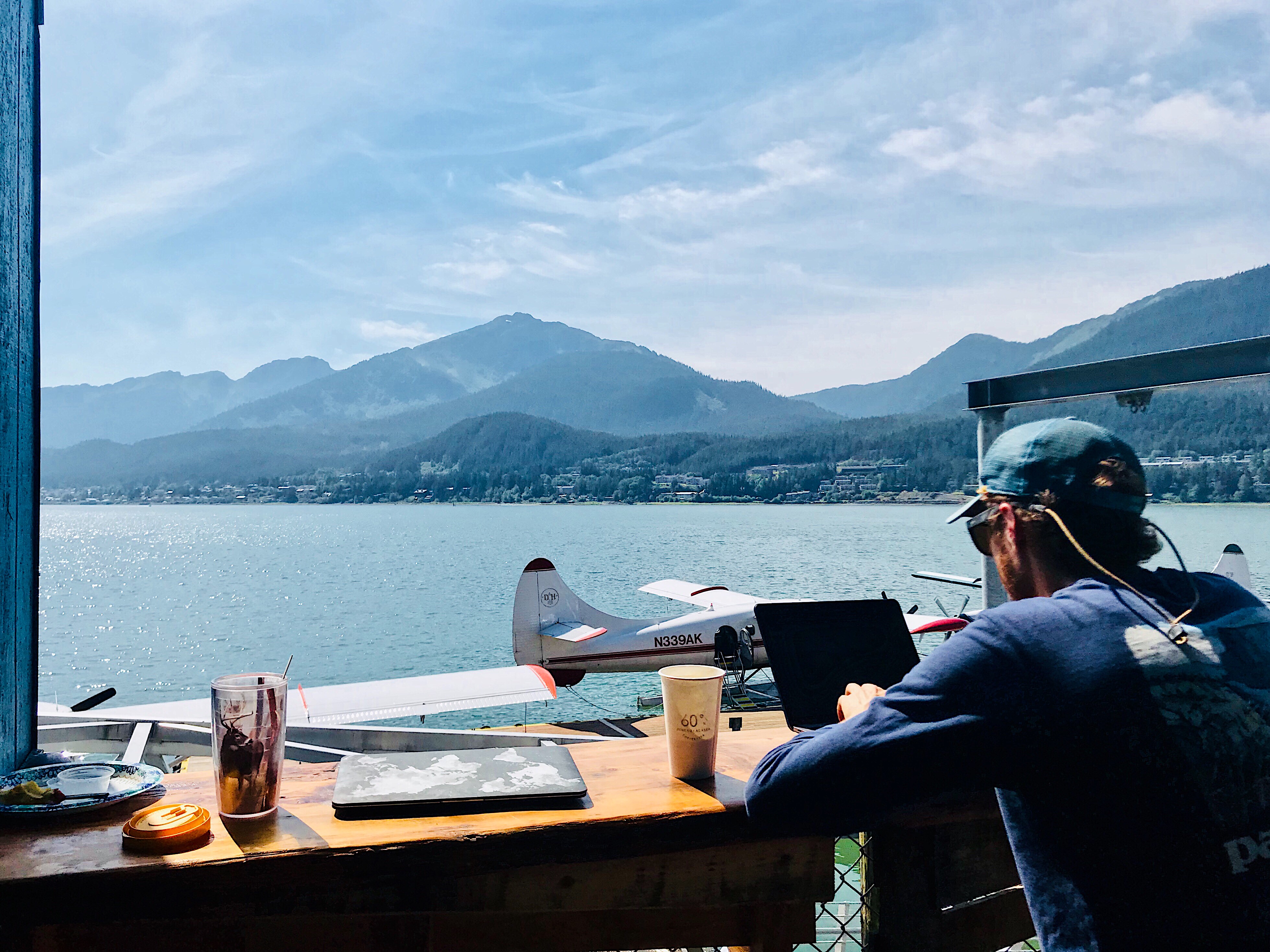
60 Degrees North Coffee & Tea, Juneau, Alaska
60 Degrees North is a pretty neat coffee shop on the Wharf in Juneau. Although the Wharf is pretty touristy (most areas in Juneau felt like a cruise terminal), this place had great views of the harbor, an outdoor seating area, and sustainably harvested Chaga teas and coffees. The photo below is of us working there one day this past summer.
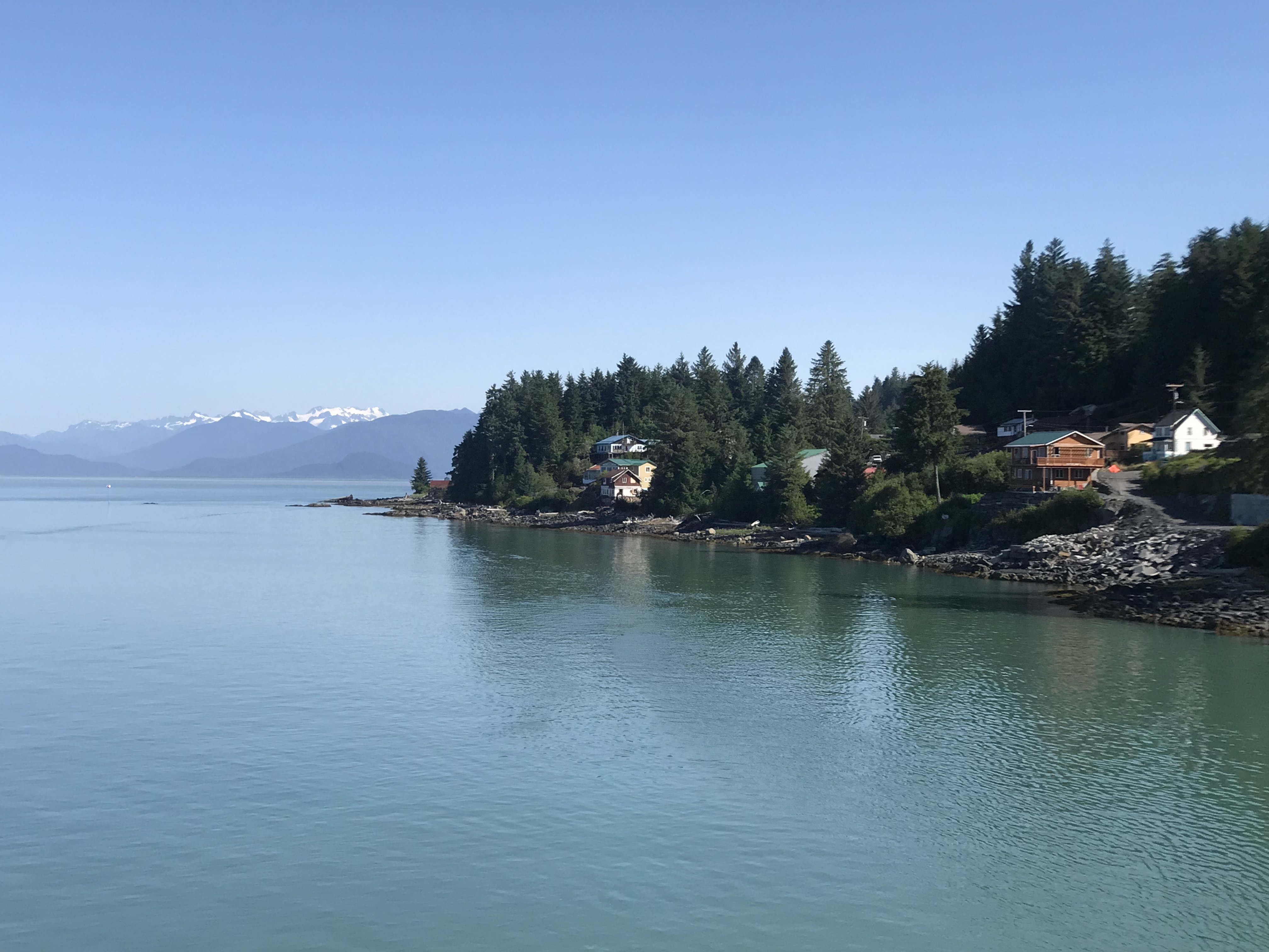
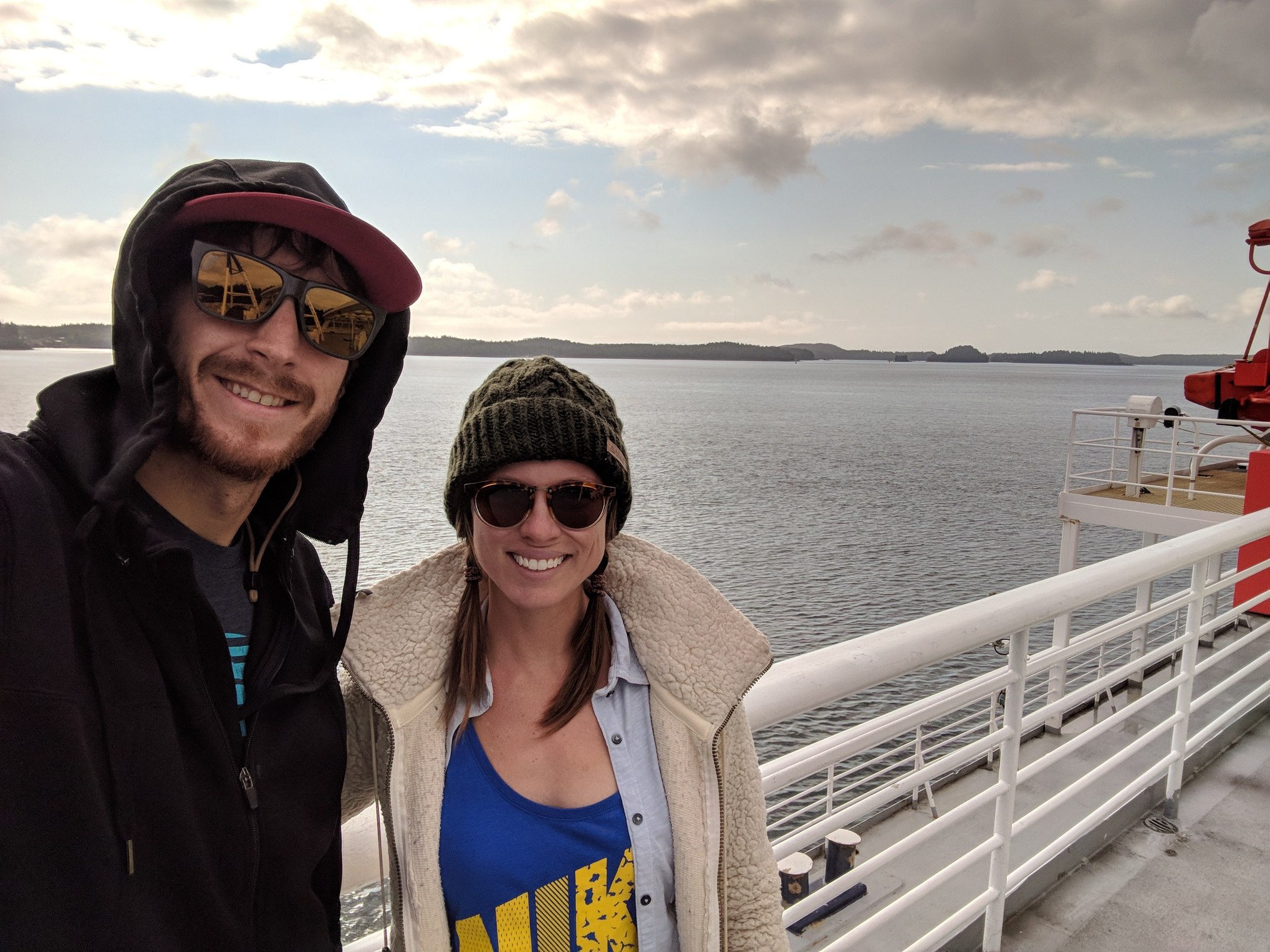
Alaska Marine Highway System Ferry – Inner Channel
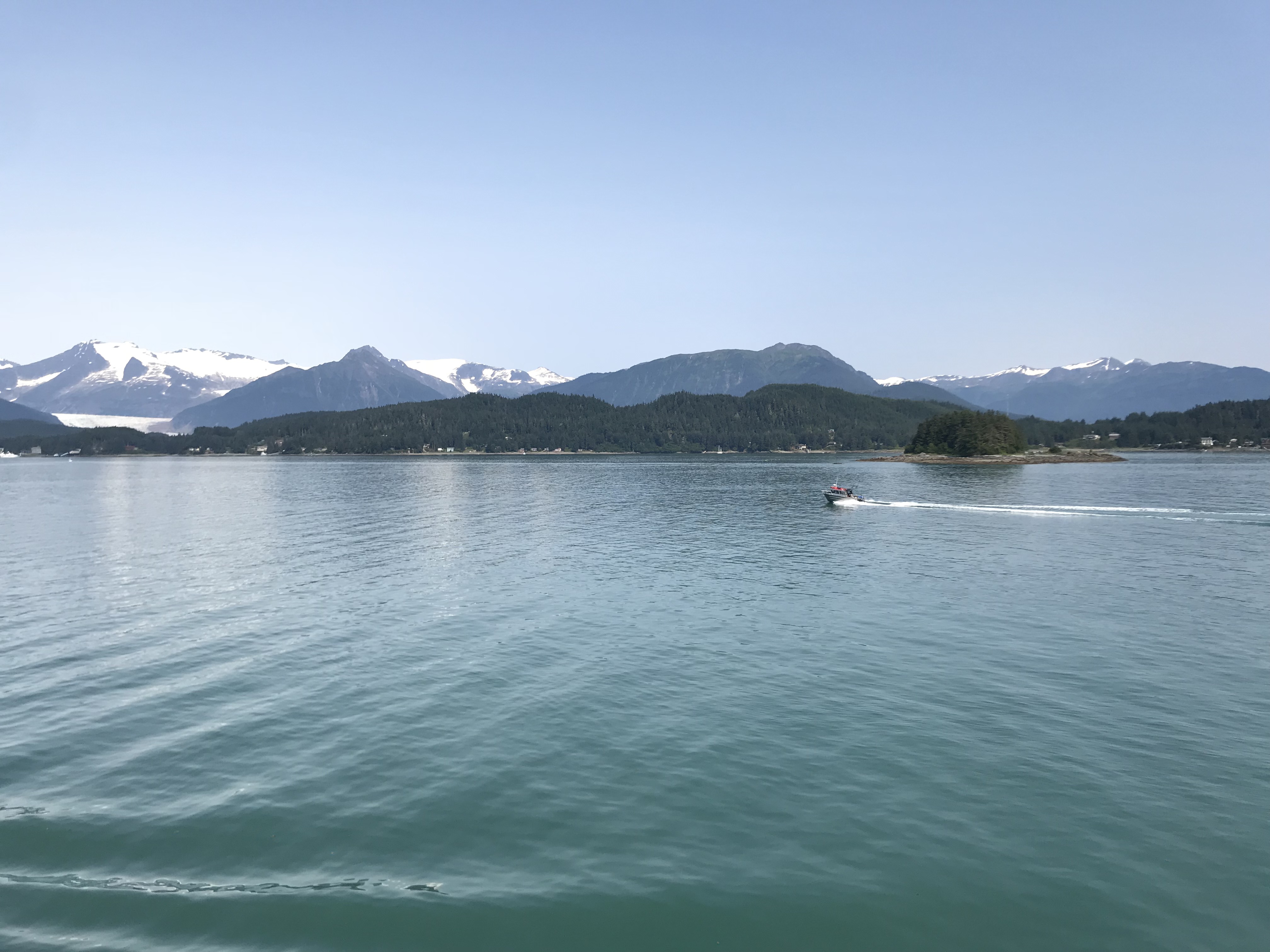
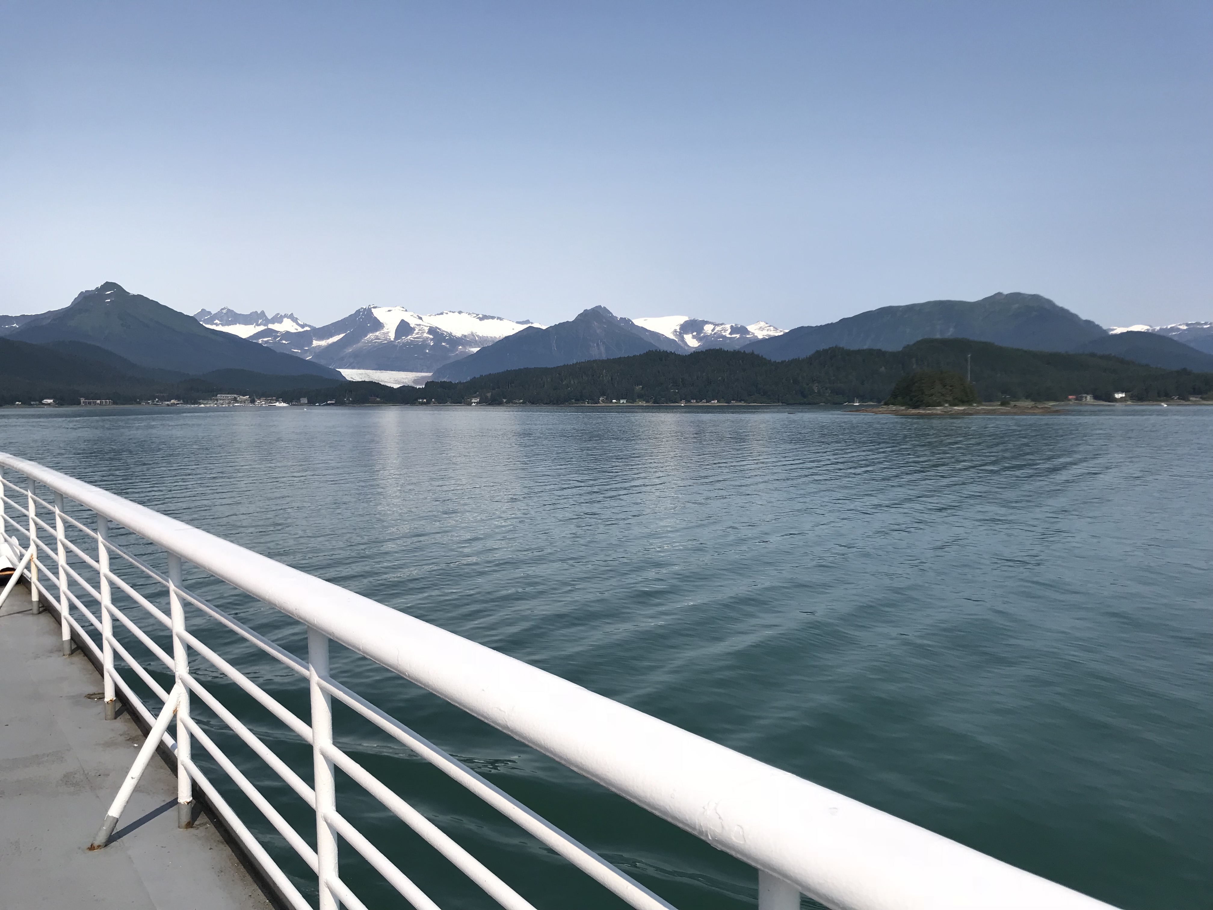
The Alaskan Marine Highway Ferry system is one of the best ways to see the Inner Channel, and cut off some of your drive time. We took a 48 hour ferry from Prince Rupert to Juneau (and then went on to Haines), but you can alight and disembark at numerous places. If you can spare the money, or are short on time, I’d recommend it. You cannot drive to the Inside Passage, so you need to either fly, take a ferry, or take a cruise. If you fly, you miss most of the journey, which is an experience in itself. It’ll be some of the best scenery you’ve ever seen, and you’re nearly guaranteed to see whales (we did). If you take a cruise, you only see the cruise ports, which are the worst parts of every area. The ferry is also really cost-effective (see below).
Alaska Marine Highway Cost – If you don’t take a vehicle, tickets are really cheap ($125 each, I believe). Our total cost for both legs was $700. That included tickets for us and the truck camper. The larger your rig (ours is really small), the more your ticket will cost. You can also buy a sleeping cabin on the boat, which increases the cost of your ticket. Your cost will also vary by your port of entry and departure. It’s a lot more expensive if you start from Seattle. We started from Prince Rupert.
Alaska Marine Highway Stops – There are lots of stops along the Inside Passage, however many are late at night (or early in the morning, however you want to look at it), and very fast (30 minutes or less), so don’t expect to have time to get off and see other places much. The longest stop you’ll have is 3 hours. Our stops were as follows: Ketchikan (1am stop first night; I slept through it); Wrangell (too fast to disembark); Petersburg (got off and walked around for 10 minutes); Kake (too fast to disembark); Sitka (stopped at 3:30am until 6:30am; Walked around for an hour; Not long enough to make it the 7 kms to the town because we didn’t exit the boat until 5am).
Whale Watching on Alaska Marine Highway – You can expect to see whales on the trip, especially if you go all the way to Juneau. We saw a pod of humpbacks feeding while en route to Kake.
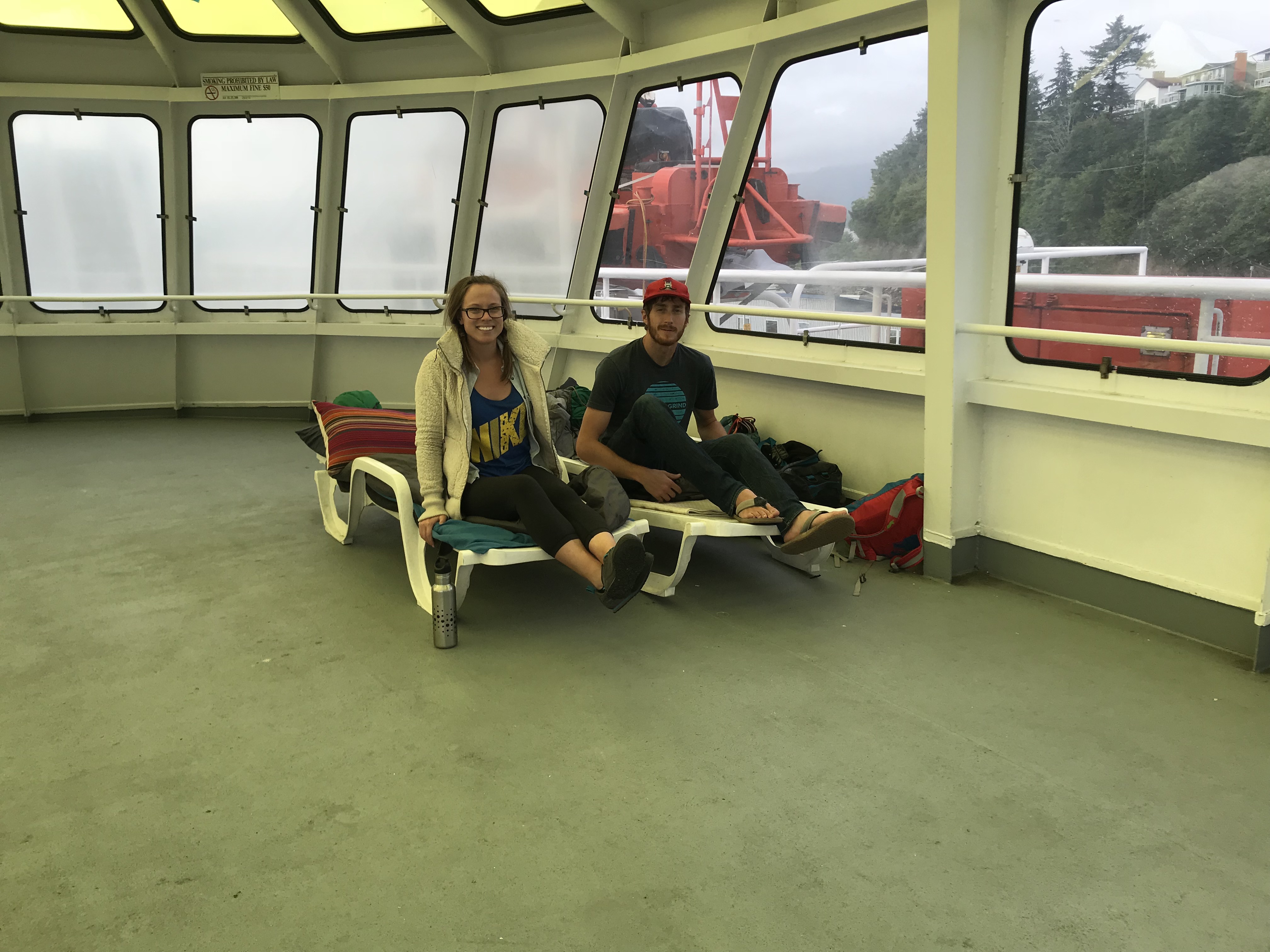
Sleeping Arrangements on Alaska Marine Highway – You either have to sleep in the solarium, in the former on-ship bar, in the aft deck, or buy a sleeping cabin. You can’t sleep in or even go to your vehicles except during stops (however, people with pets can go to the vehicle deck to walk their pets at other points too). We slept on the solarium, and it was really awesome. It’s a heated area on the top of the boat with a semi-clear roof that blocks sun and cold, but allows you to see scenery. The floor is concrete, but there are plenty of white deck chairs that lay flat. We laid all our bed gear on them, and were quite comfortable. Others brought tents and hammocks that they slept in. It was surprisingly warm too, and quiet since I wear earplugs when sleeping anyway (ha!).
Food on Alaska Marine Highway – You can bring your own food on deck (we had bags of food and booze beside our solarium sleeping area), or purchase breakfast, lunch, or dinner food from the ferry cafeteria. The food wasn’t particularly good or bad, which was better than I expected.
Showers on Alaska Marine Highway – There are free showers on the boat! They’re clean, and no one else seemed to use them. We took full advantage of this nice convenience.
Booze on Alaska Marine Highway – There is no booze for sale or allowed on the ferry. However, one of the shipmates told me that they know we all sneak booze and don’t care as long as we put it in incognito containers. We snuck booze the whole time and no one noticed or cared.
Enjoyed reading your post!! Lots of great info and ideas for a driving trip. We made our first trip to Alaska this last summer with family. It was rather controlled because it was a cruise package, but WOW, Alaska is absolutely beautiful!!! We saw the three peaks of Denali all three days we were there (mid-July). I’d go back in a minute and we plan to. Would love to truck camp while there.
Thanks again for the wonderful info and the great photos.
Hi Tim – I really appreciate the comment and feedback! It sounds like you had a great Alaskan adventure this summer as well. Who knows, we may have even crossed paths! Also good for you on seeing Denali! That’s a rarity. We’re tentatively planning to make the trek again this summer, so I hope to have more to add to this post. Keep us informed on when you’re heading back, or feel free to reach out if you have truck camping questions!