Backcountry Camping in Death Valley
Death Valley – the lowest, driest, and hottest place in the western hemisphere – is quite possibly the most diverse yet intense landscape I’ve ever encountered. We were able to spend a few days backpacking and truck camping in it, and it was one of the best camping experiences of my life. Below is the path we followed, a guide to where you can backcountry camp, and tips for things to do if you’re able to go for longer (or enter from the western side).
Choosing a Side
We entered Death Valley from the east (Vegas), which is important because the park is quite large, thus making it difficult to cover both sides in less than 3-4 days. If you have less time than that, I’d suggest choosing a side (most of the big attractions are on the eastern side), and focusing on hitting as many places as you can on your chosen side of the park.
Badwater Basin
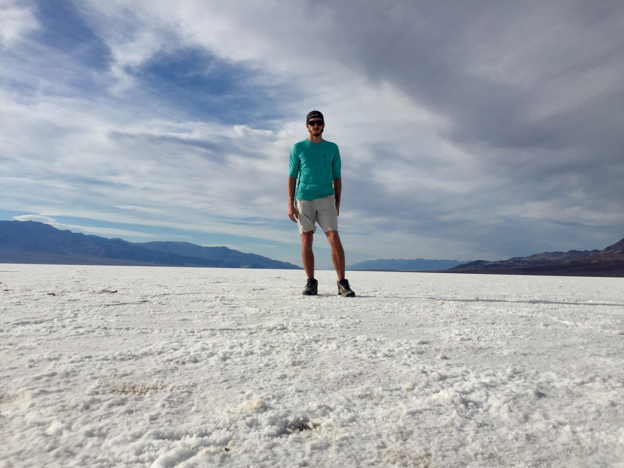
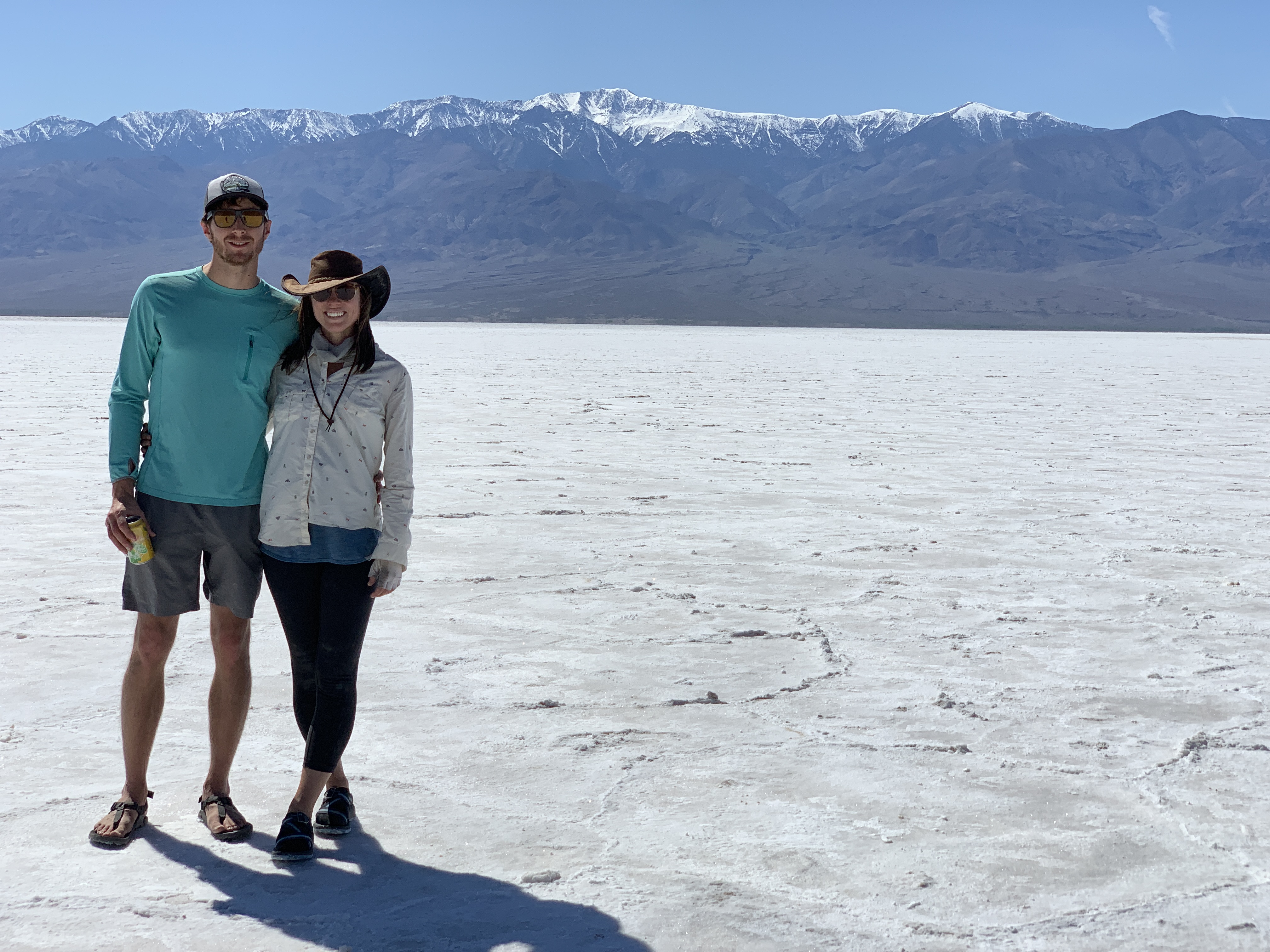
Badwater Basin was my favorite part of Death Valley, largely because I have never seen anything like it. It’s an expansive salt flat that sits 282 feet below sea level (making it the lowest point in the western hemisphere) that is 5 miles wide by 7.5 miles across, and is surrounded by white-capped mountain ranges. It looks like you’re hiking through snow, yet your body feels hotter and drier than it does after hours in the sea. We hiked through Badwater on our first day, then checked it out from nearly 1 mile above at Dante’s View on our second day. Although the basin is a bit crowded at the entrance, like everywhere in Death Valley, the further out you hike, the fewer people there are (Due, no doubt, to the 100+ degree heat you’re hiking in).
Although there was no water to be found while we visited Death Valley, I’ve read that Badwater Basin does, at times, have water. On occasion, it can even have enough to allow for paddling. However, I thoroughly enjoyed the other-wordly salt flat, which I found much more unique than a lake.
Location: Southern end of Death Valley eastern side via Badwater Road.
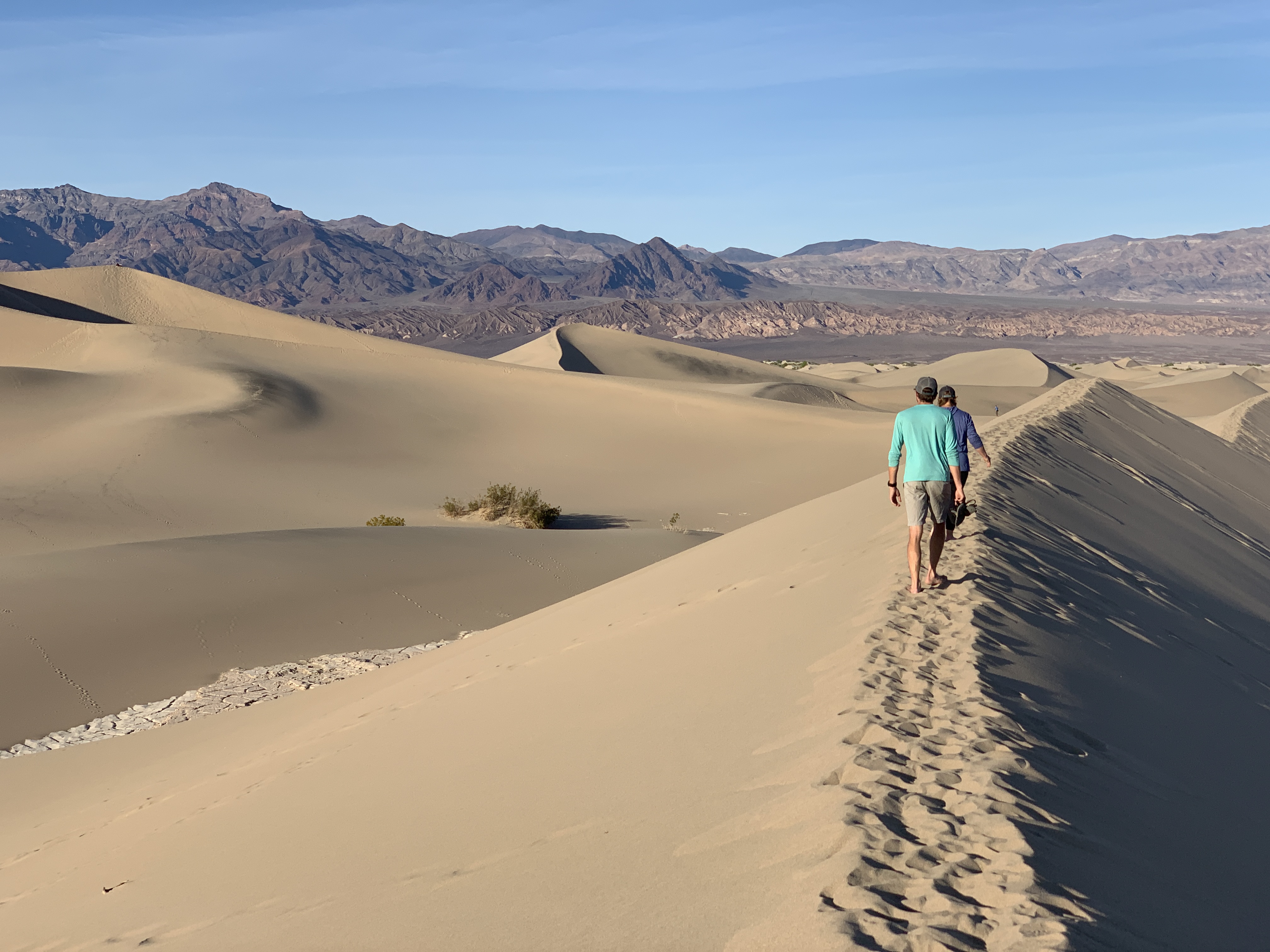
Mesquite Flat Sand Dunes
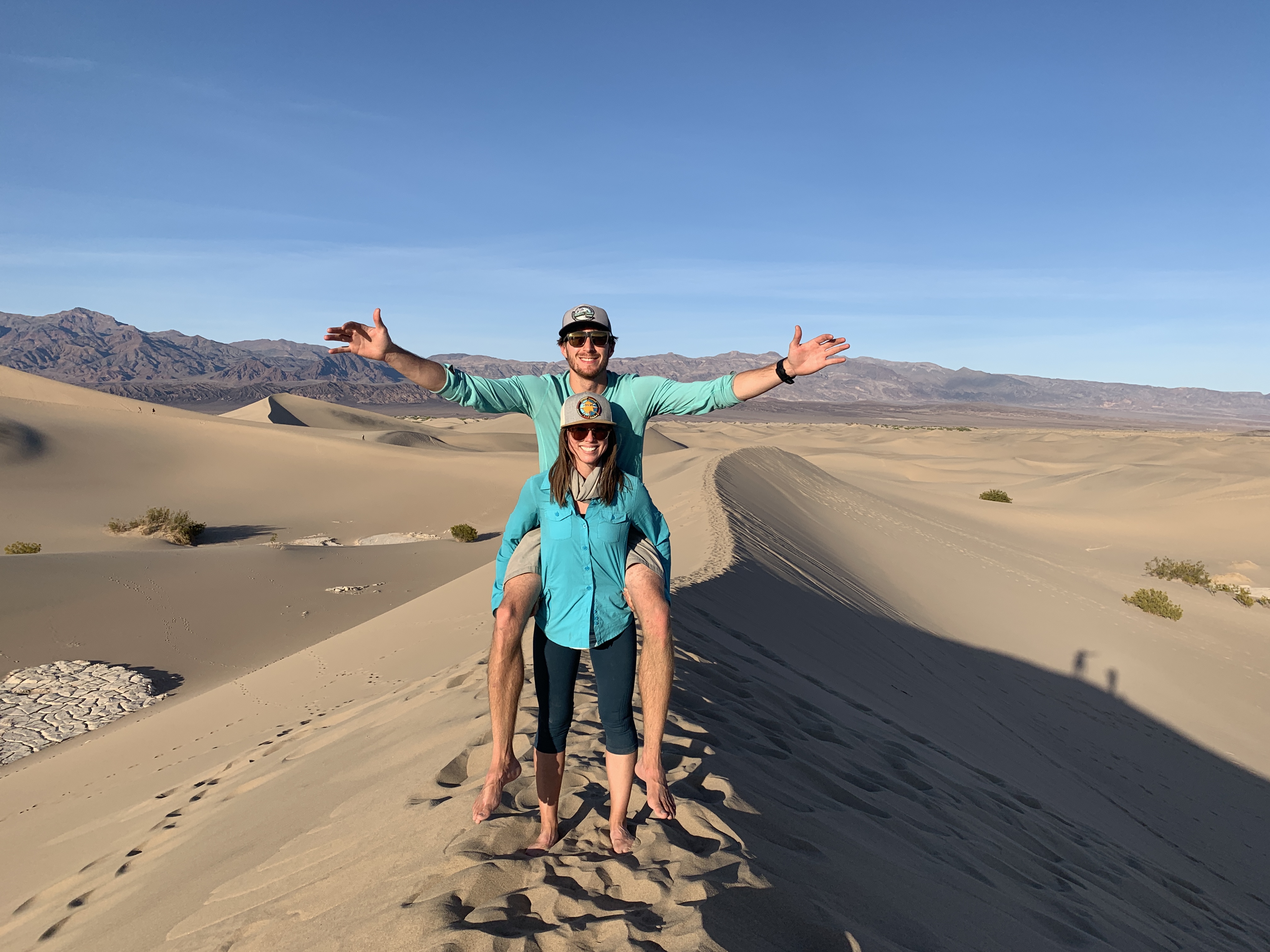
Mesquite Flat Sand Dunes were a close second to Badwater Basin. Despite being the easiest and most common sand dunes to visit in the park, they did not disappoint. The largest dune rises only 100 feet, but they span a massive area. Surrounded by mountains on both sides, an hiding an ancient lake bed that is periodically visible underneath, the dunes are a prime spot for photography and (somewhat strenuous) hiking.
Location: Just east of Stovepipe Wells (past Furnace Creek, toward Beatty, I believe).
Other sand dunes we would have visited if we had more time (due to them being more difficult to reach):
Eureka Dunes: From Ubehebe Crater Road (far north), travel 44 miles of graded dirt road to the dunes.
Saline Valley Dunes: These can only be accessed by what is described as a ‘grueling and time-consuming drive.’ Most backcountry 4×4 routes in the park are 3.5 to 4 hours one way.
Panamint Dunes: To get to these, you have to find an unmarked dirt road off of 190, drive 5 miles down it, then cross-country hike 3 miles.
Ibex Dunes: Hike 1 mile from Saratoga Springs to find these dunes.
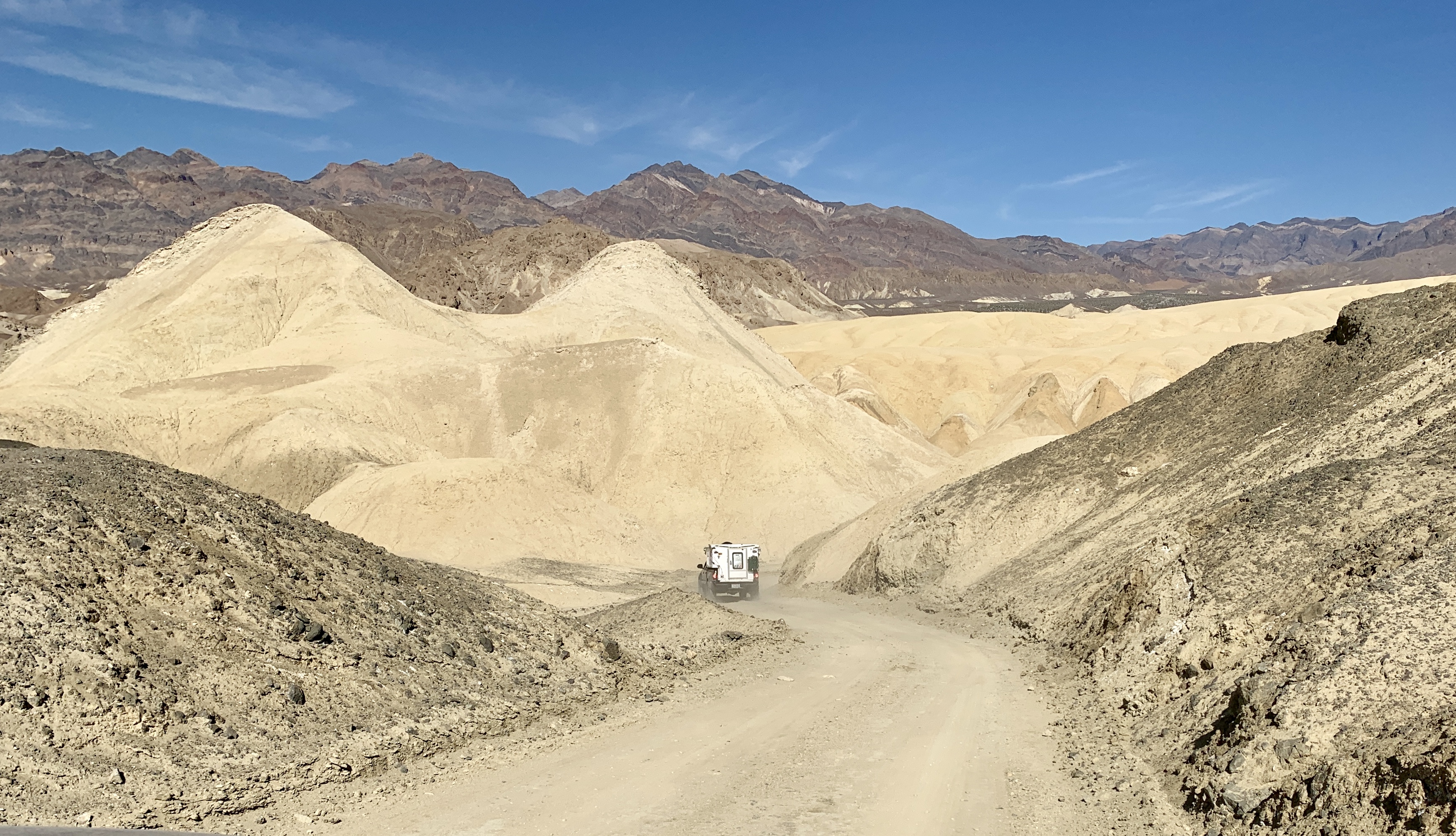
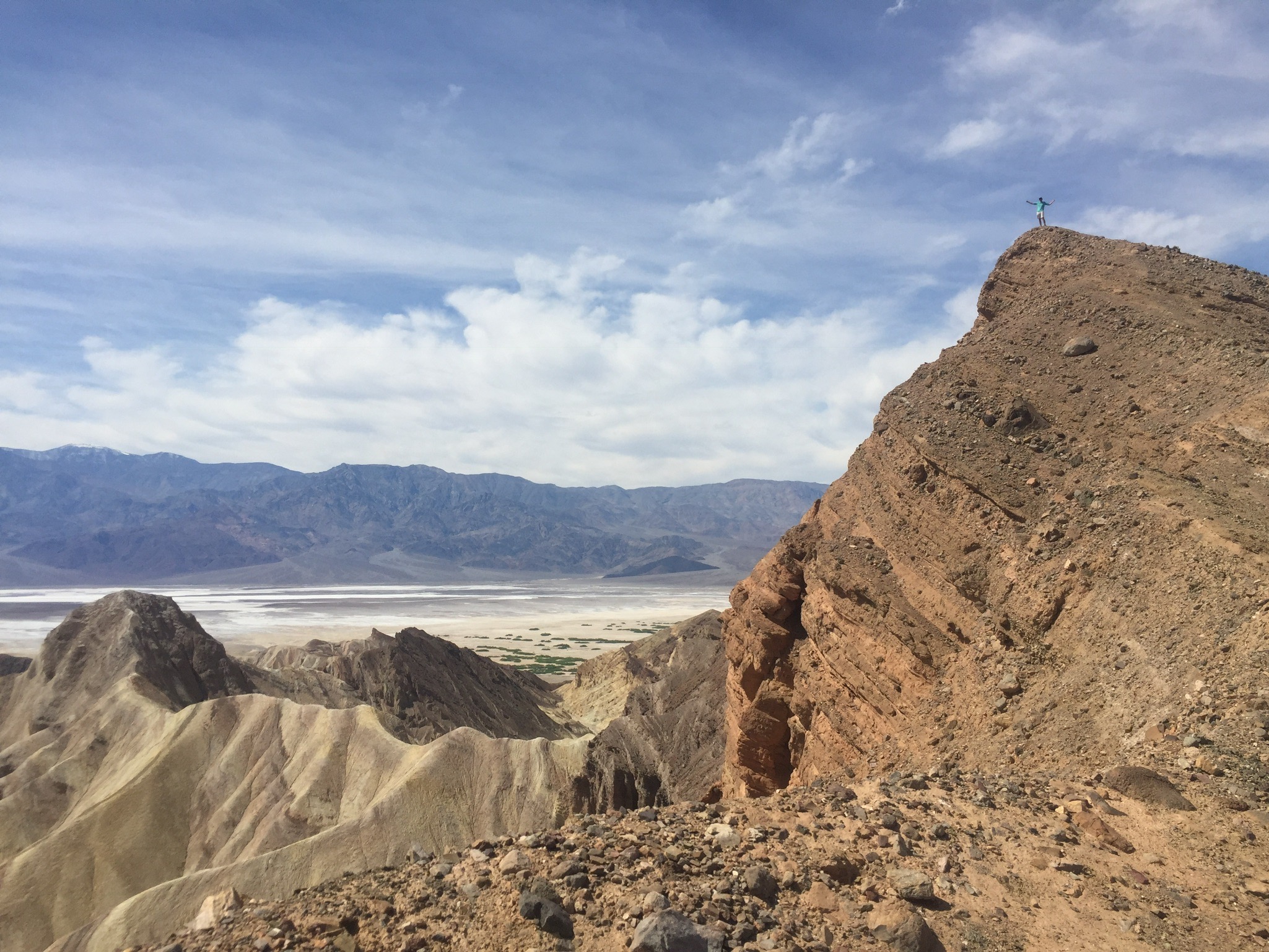
20 Mule Team Canyon
20 Mule Team Canyon is a 2.7 mile, one way, dirt road that takes you through colorful badlands that are similar to those at nearby Zabriskie Point. It’s narrow, but easy to pass through with an SUV. During good weather, most non 4-wheel drive vehicles could drive it with relative ease. It’s roughly a 15ish minute drive, but again was one of the highlights of the trip. The badlands slope dramatically down both sides to form a barrier around the road, making you feel more like you’re in a surrealist painting than the living world.
Location: Near Zabriskie Point and an eastern entrance on 190.
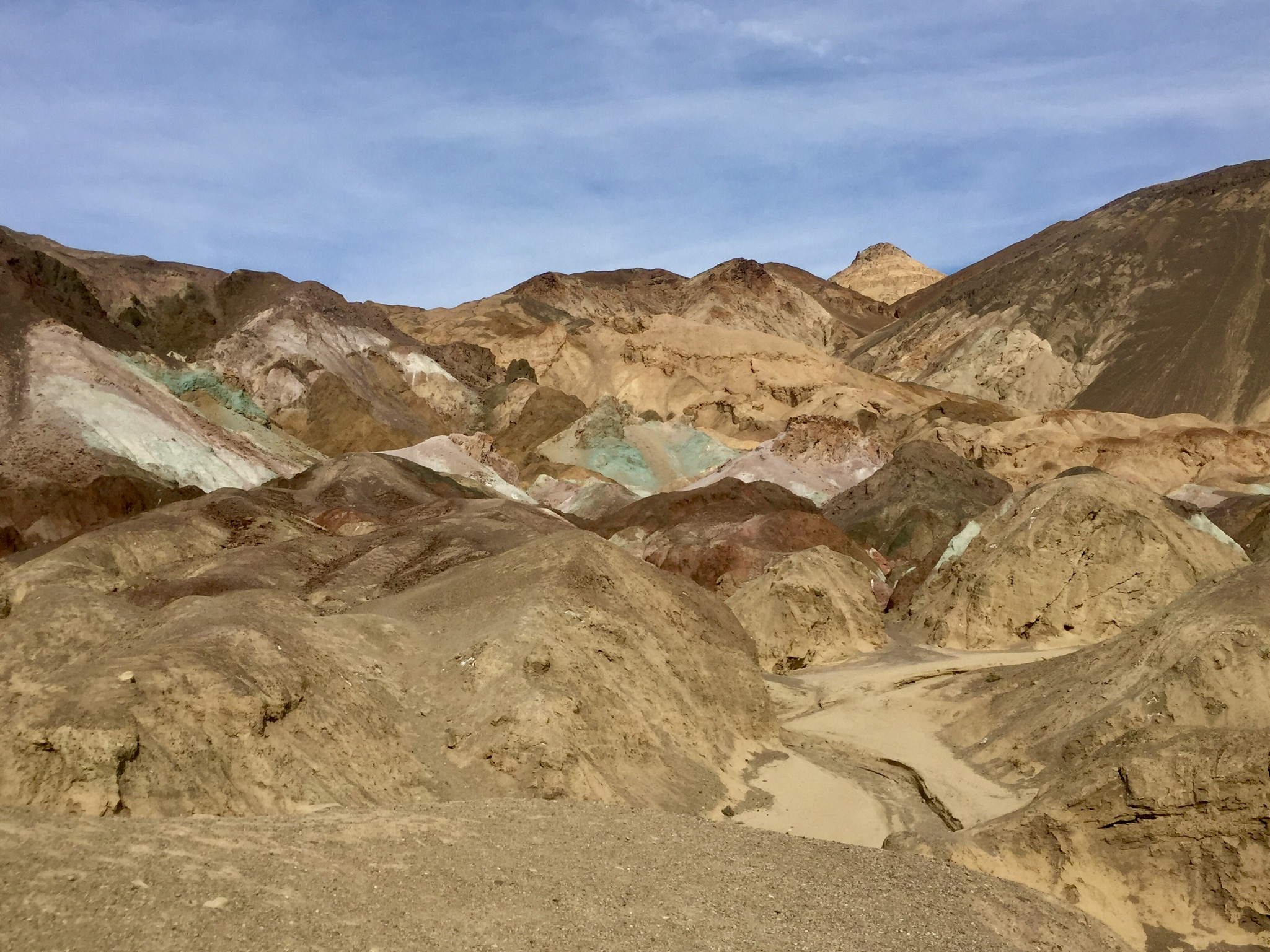
Artist’s Palette & Artist’s Drive
Artist’s Drive is a 9 mile, paved, one-way loop that is accessible when driving from Furnace Creek (one of the few areas with food, water, and other libations) to Badwater Basin. It’s a beautiful drive that takes you close to a colorful section of the Black Mountains. Artist’s Palette is a short hiking area through a particularly colorful portion – that includes small badlands tinted turquoise, orange, pink, and green. We read that the colors are best in late afternoon, so we drove through this after 3pm. It is a truly stunning site; the photos and timelapse from my iPhone below don’t do it justice.
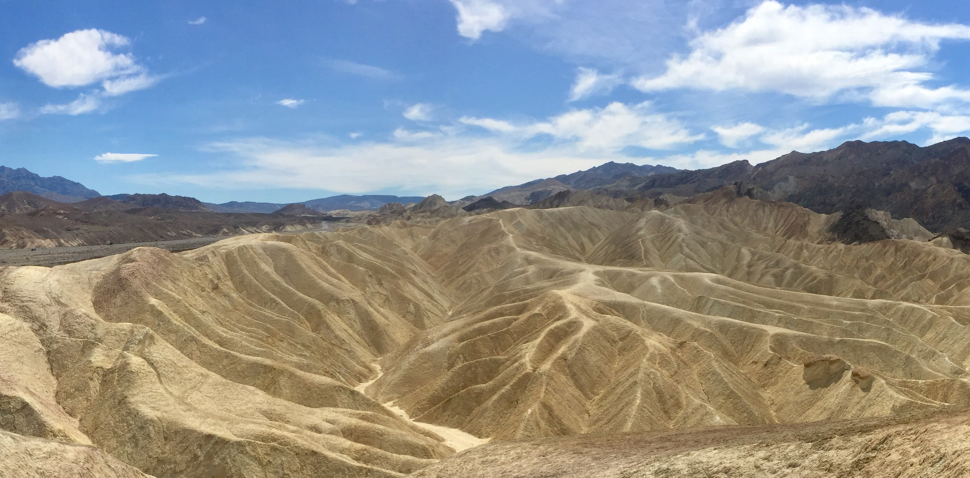
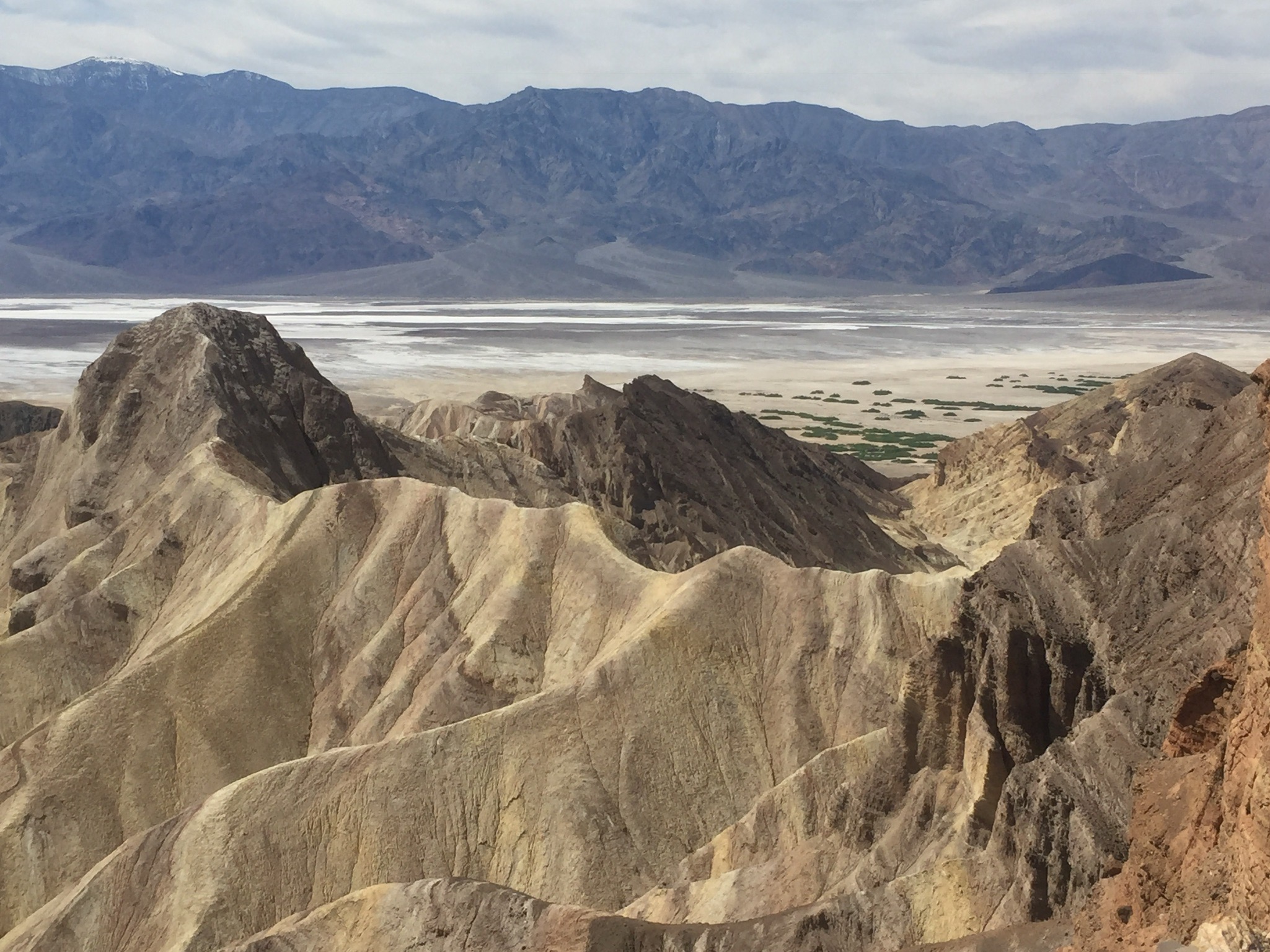
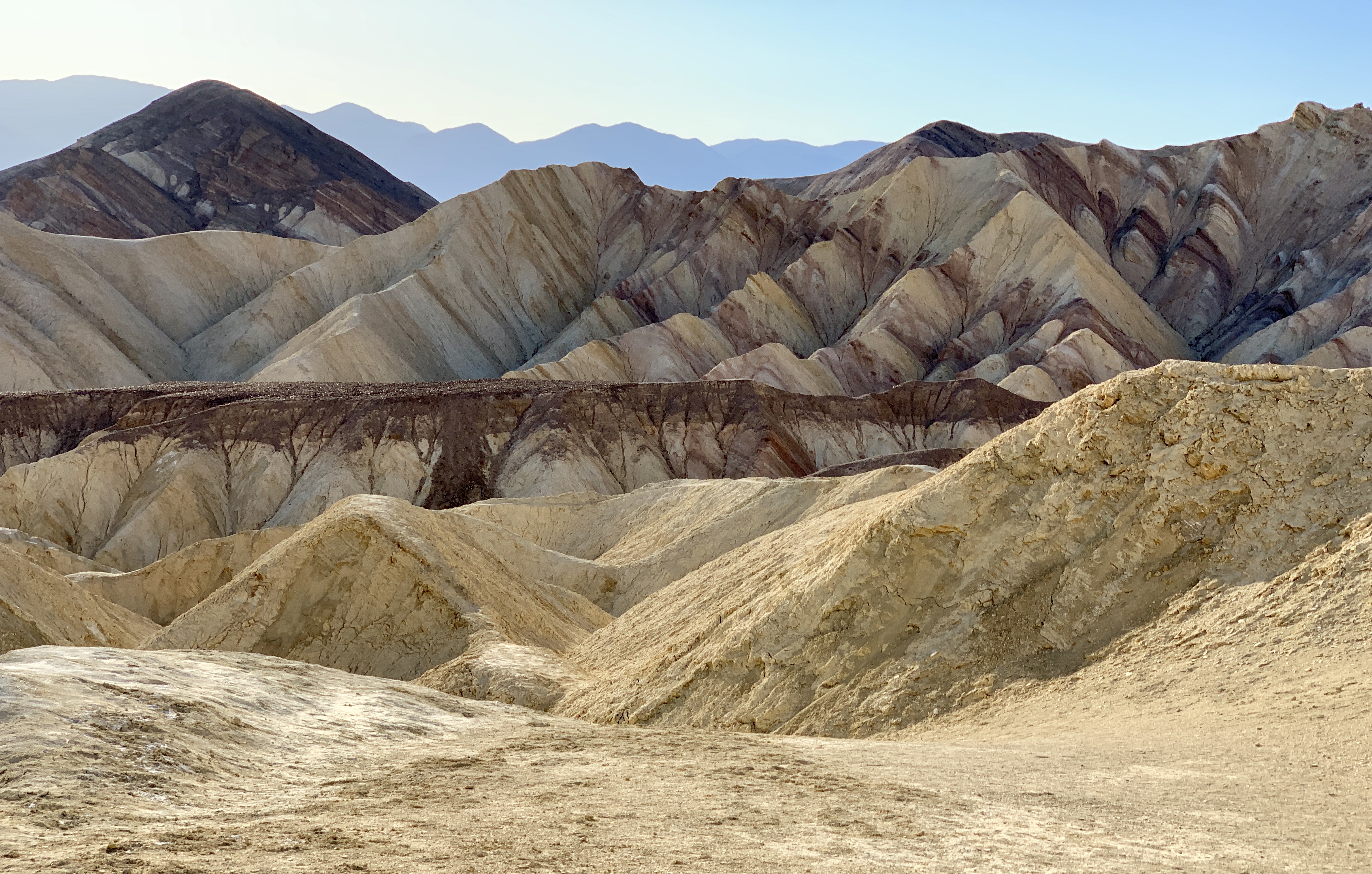
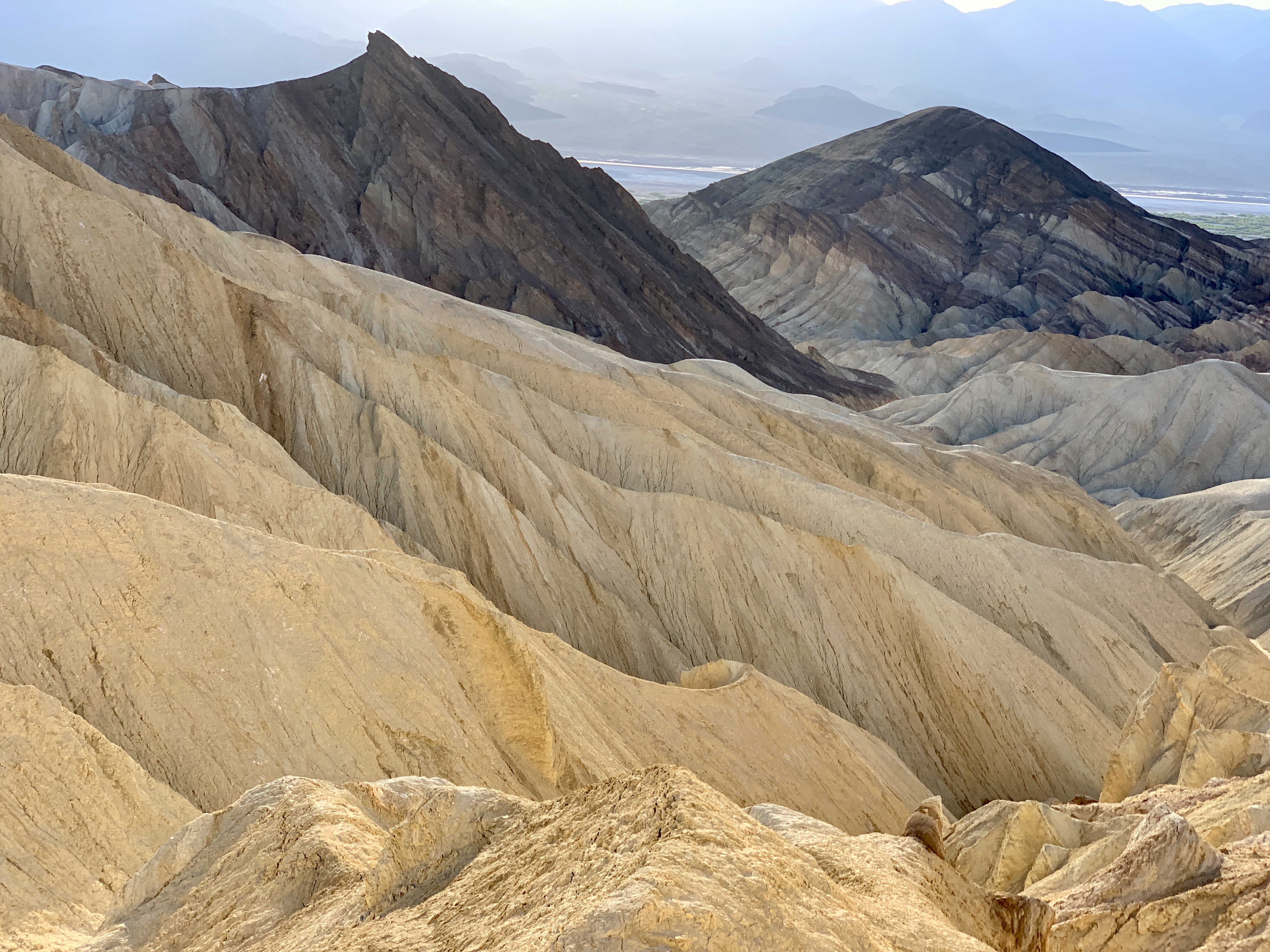
Zabriskie Point & Hiking the ‘Badlands’
Zabriskie Point overlooks rolling, colorful, tightly-packed badlands with the Panamint Mountains in the distance. You can view the badlands from above, or hike out into them. We first hiked a trail we found to the right at the entrance, which took us straight up a long trail directly above the badlands. We hiked out for a few miles, then headed back. Although not a loop trail, it’s well-worth checking out (assuming you can handle the heat) since it offered some of our most dramatic views and photos of the trip. After hiking back, we headed into the Badlands loop trail, which takes you through the badlands and the exposed basin they surround. Although the trail was unbearably hot and somewhat reflective, it was well worth it.
Location: 4 miles east of Furnace Creek on 190.
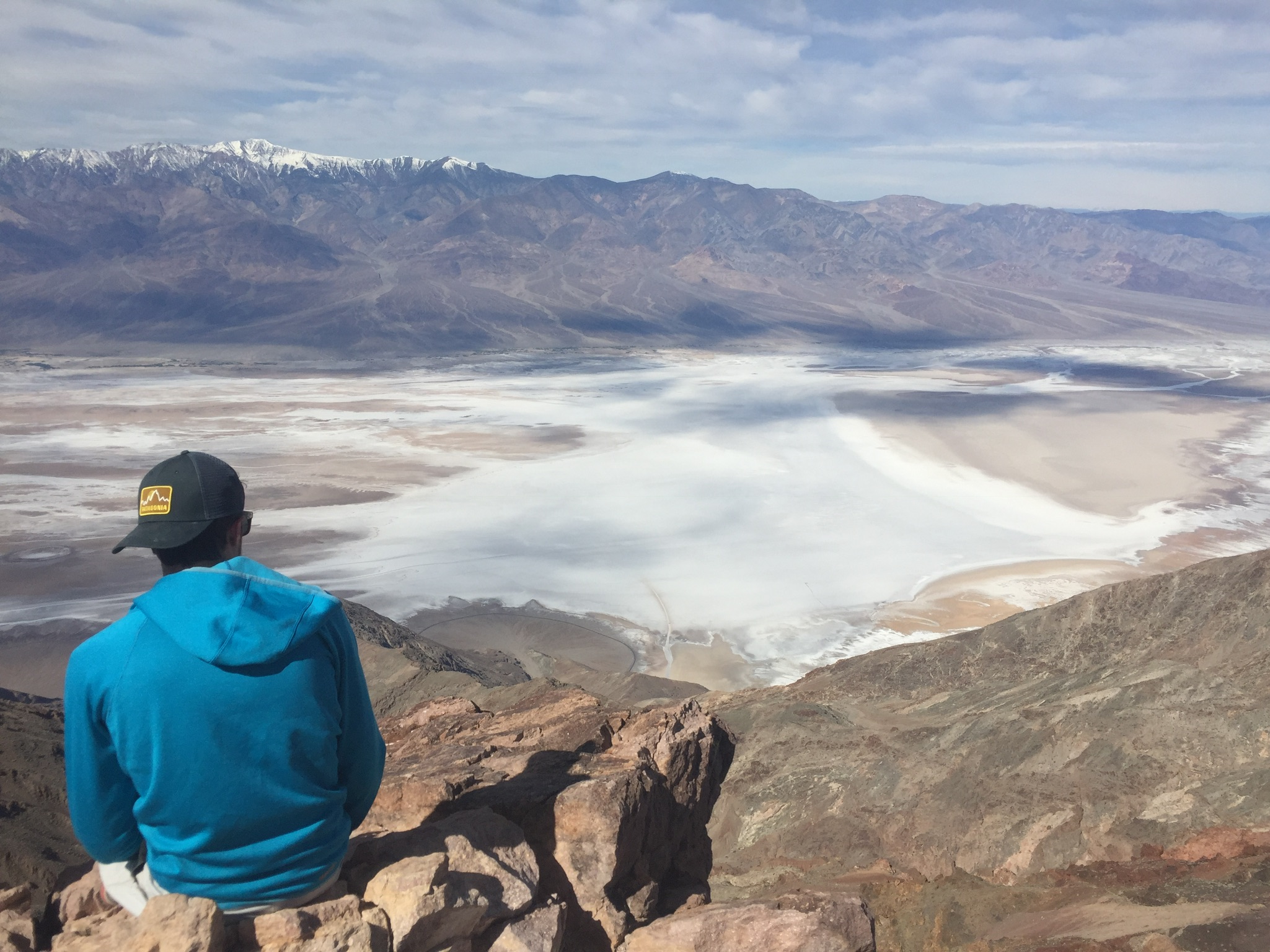
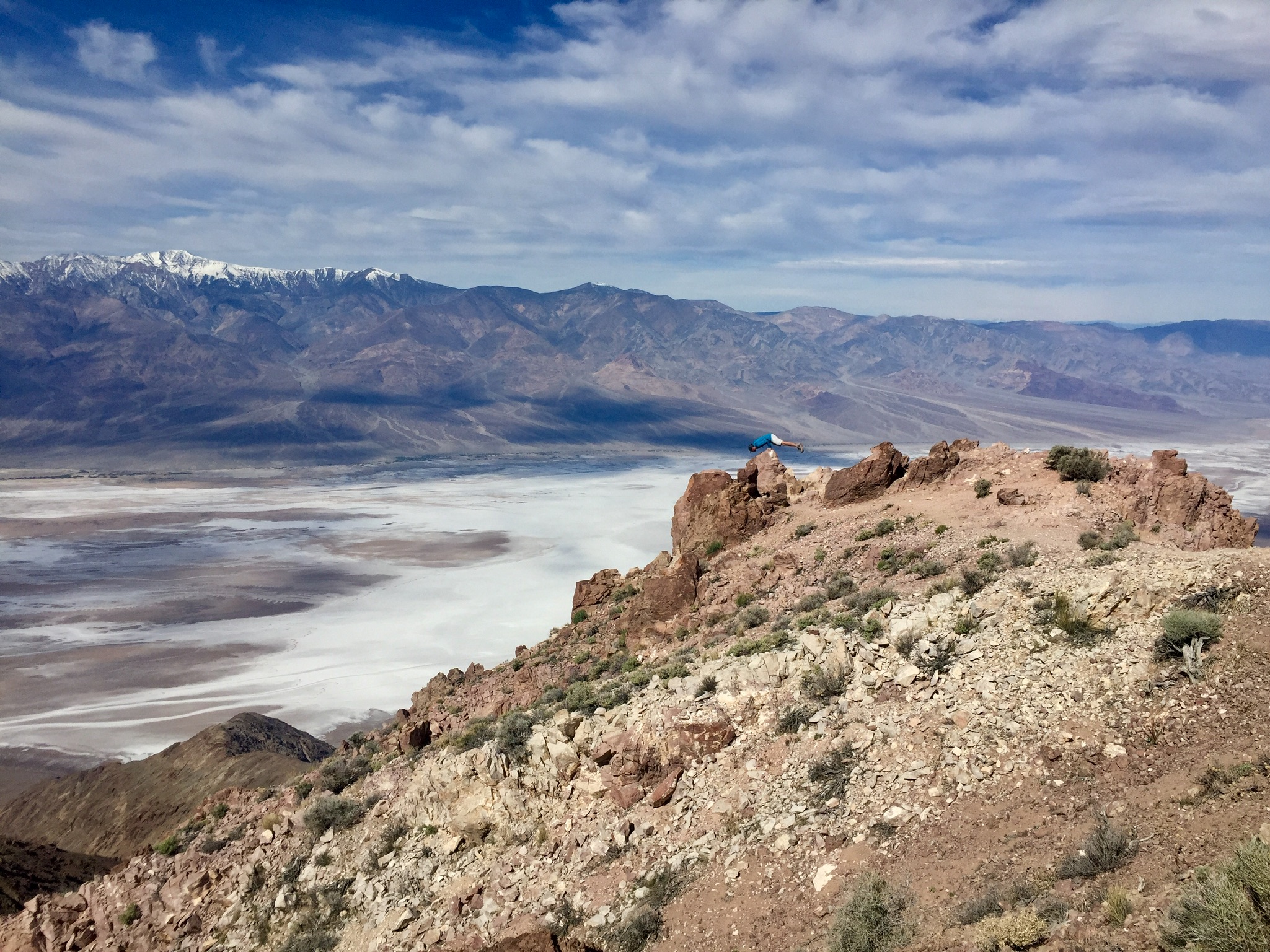
Dante’s View
Dante’s View, rising 5,478 feet above sea level, provides one of the best perspectives of Death Valley. From it you can hike around and view Badwater Basin from above, the valley, and the mountain chains that surround Death Valley.
Location: East from Zabriskie Point on 190. Turn at the sign posted for Dante’s View, then drive 16 miles up a twisty road to the top.
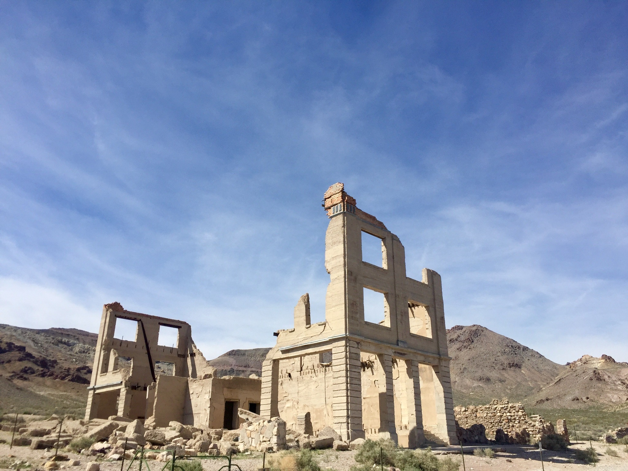
Rhyolite Ghost Town
We checked out Rhyolite Ghost Town because my parents highly recommended it. It’s 30ish minutes (one way) out of the way. I’m glad we saw it, but I probably wouldn’t visit it again. However, since you pass it when exiting the park via Beatty, I’d recommend checking it out as you’re leaving. Note: There are a few ghost borax works and smaller ghost towns within the park as well.
Location: Exit the park toward Beatty, then follow the sign for Rhyolite.
Mosaic & Golden Canyons
We hiked all of Mosaic Canyon and were not that impressed. If you’ve seen the various slot canyons throughout Utah/Arizona, I would recommend skipping these, or just hiking 5 minutes into Mosaic to look at the granite formations, then heading back.
Locations: Mosaic – Off of the road toward Beatty to the northeast. Golden – Off of 190, near Zabriskie Point (there’s a hiking trail that takes you from Zabriskie Point to Golden Canyon).
Ubehebe Crater & The Race Track
We, unfortunately, didn’t have time to see The Race Track or Ubehebe Crater. The Crater is at the far north end of the park, near Scotty’s Castle (which was closed while we were there).
Darwin Falls
On our 2019 visit to Death Valley, we checked out a few hikes with water (yes, they exist!). The first was a short, easy 2-mile hike to Darwin Falls, which was really nice.
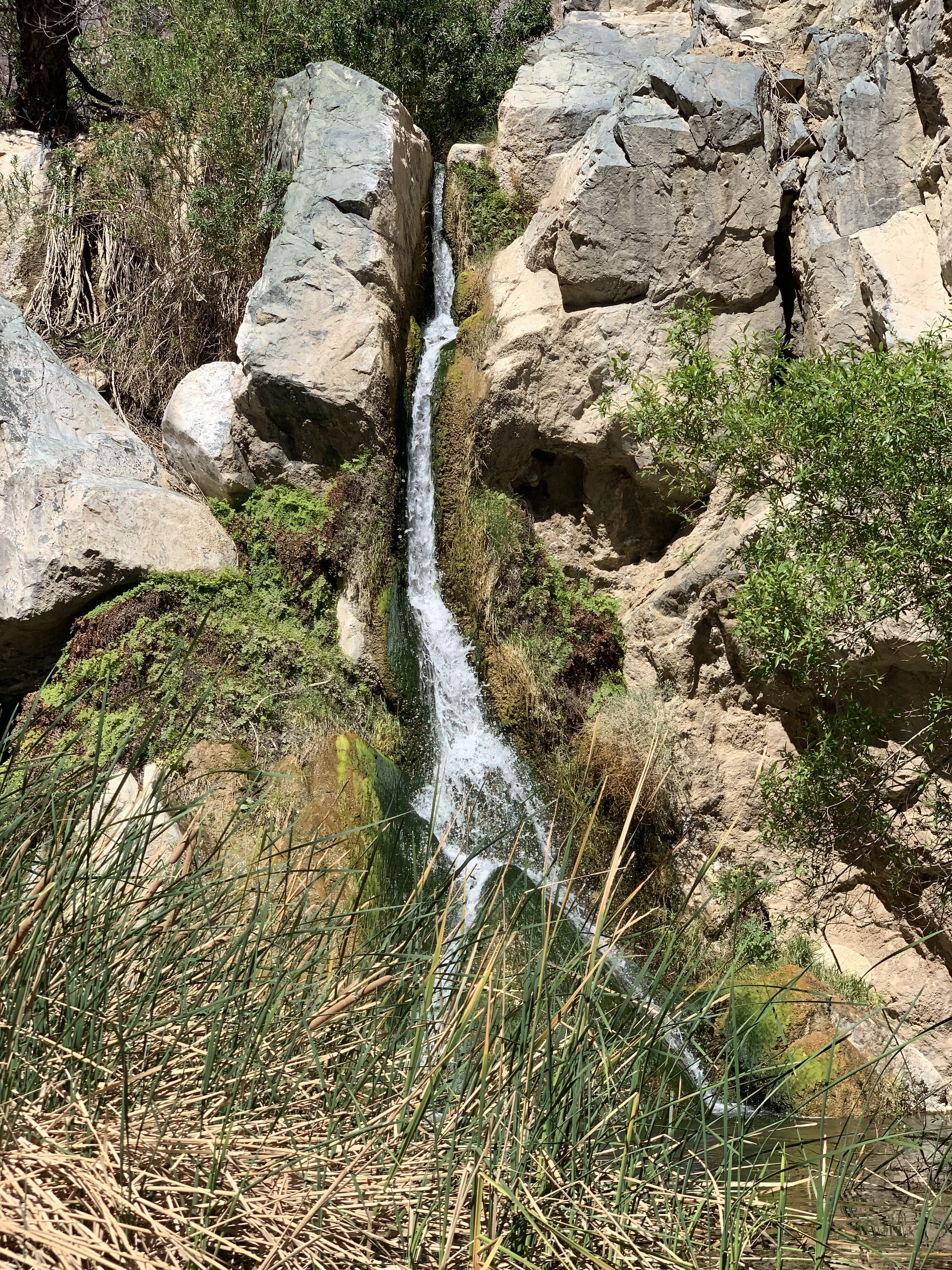
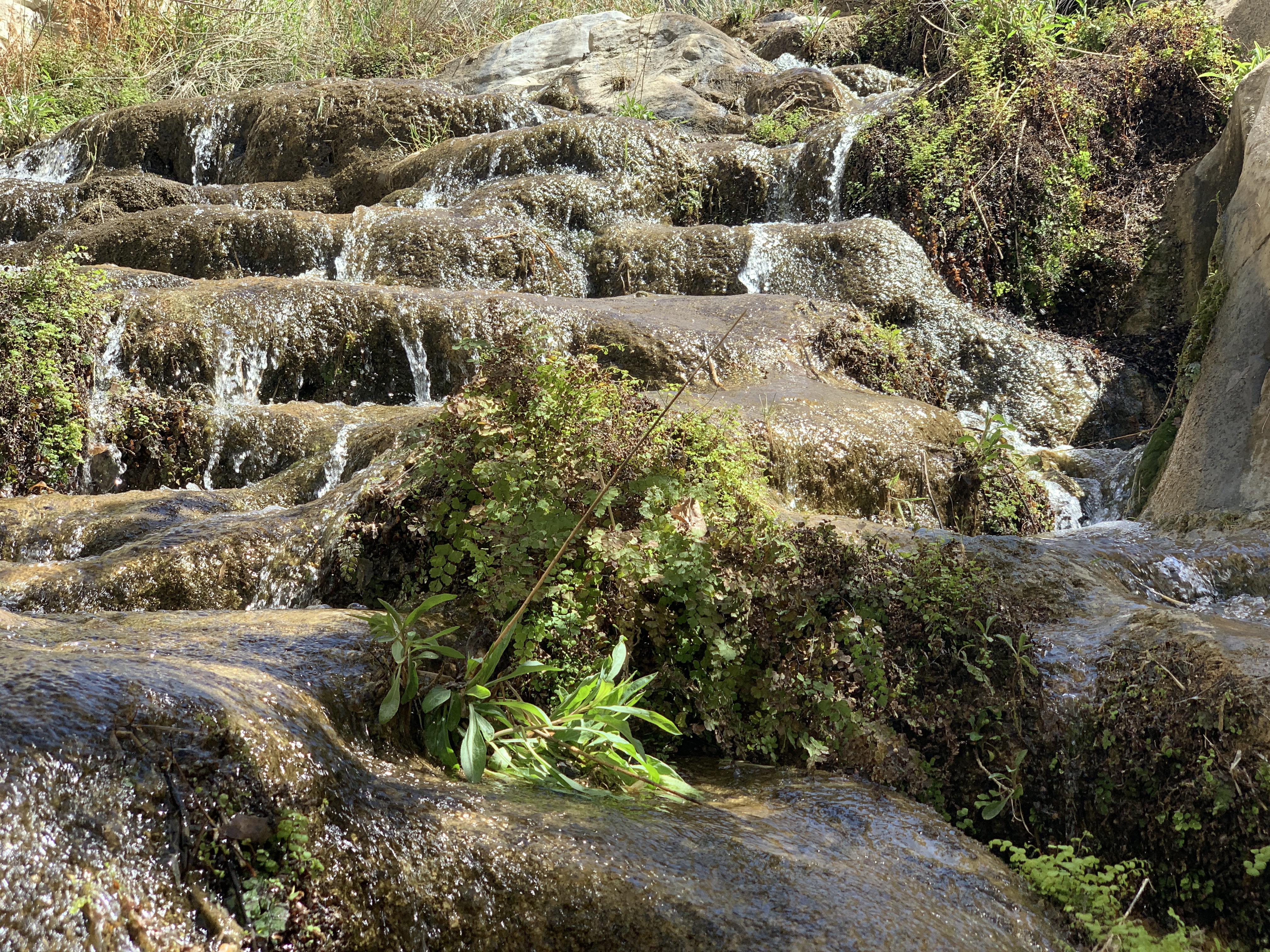
Panamint City & Waterfalls
We hiked part of the 10ish mile roundtrip trek to Panamint City ghost town. It’s a bit of a drive and effort to find the hike. If you want to do Panamint City, plan on it taking the whole day and set in for the long haul so you actually make it to the ghost town. Or, if you don’t care about ghost towns, just hike the first 3 miles with all the waterfalls, then turn around (this is what we did). This hike involves scrambling through numerous waterfalls and murky pools, so, plan to get your feet pretty wet.
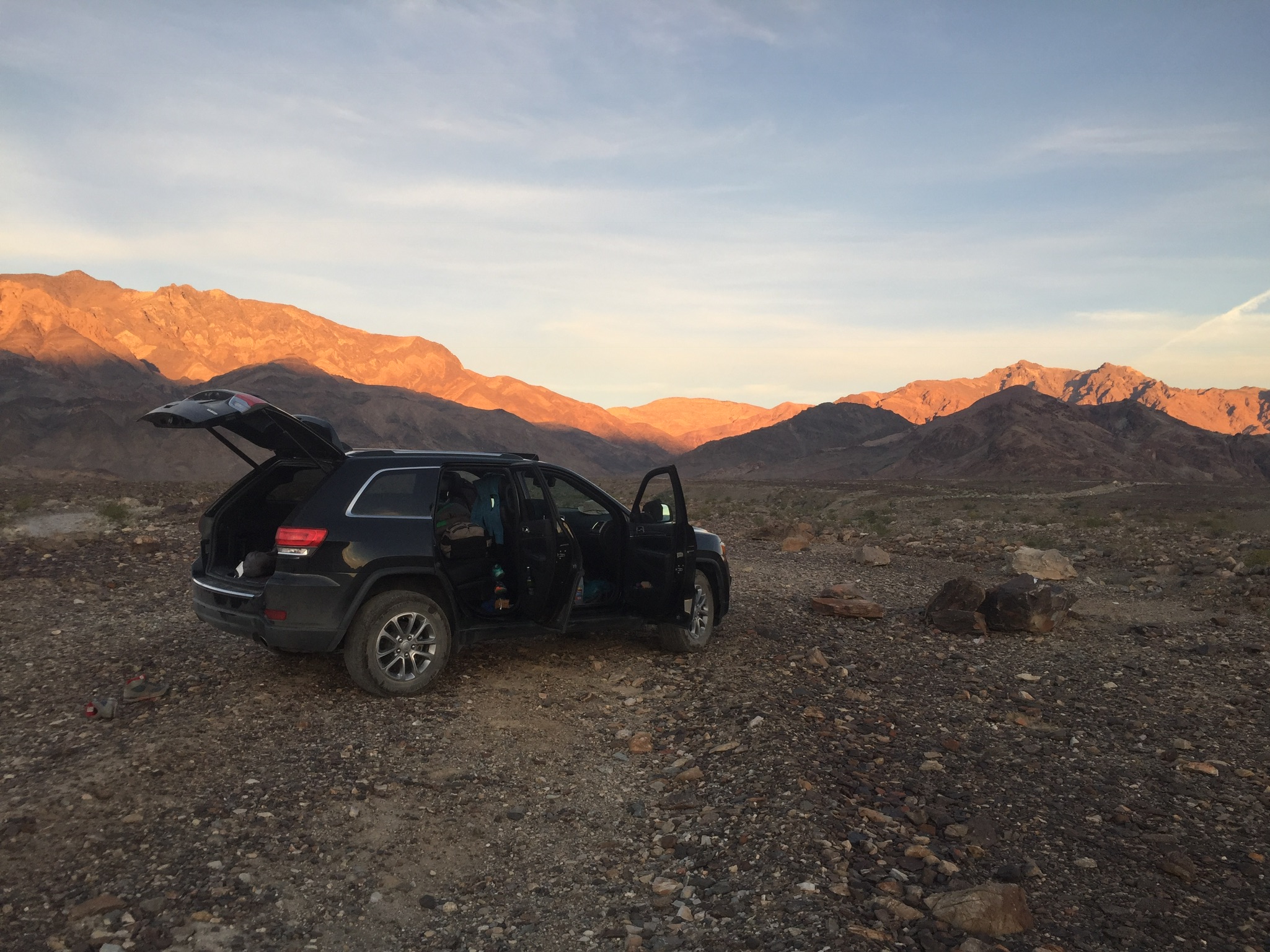
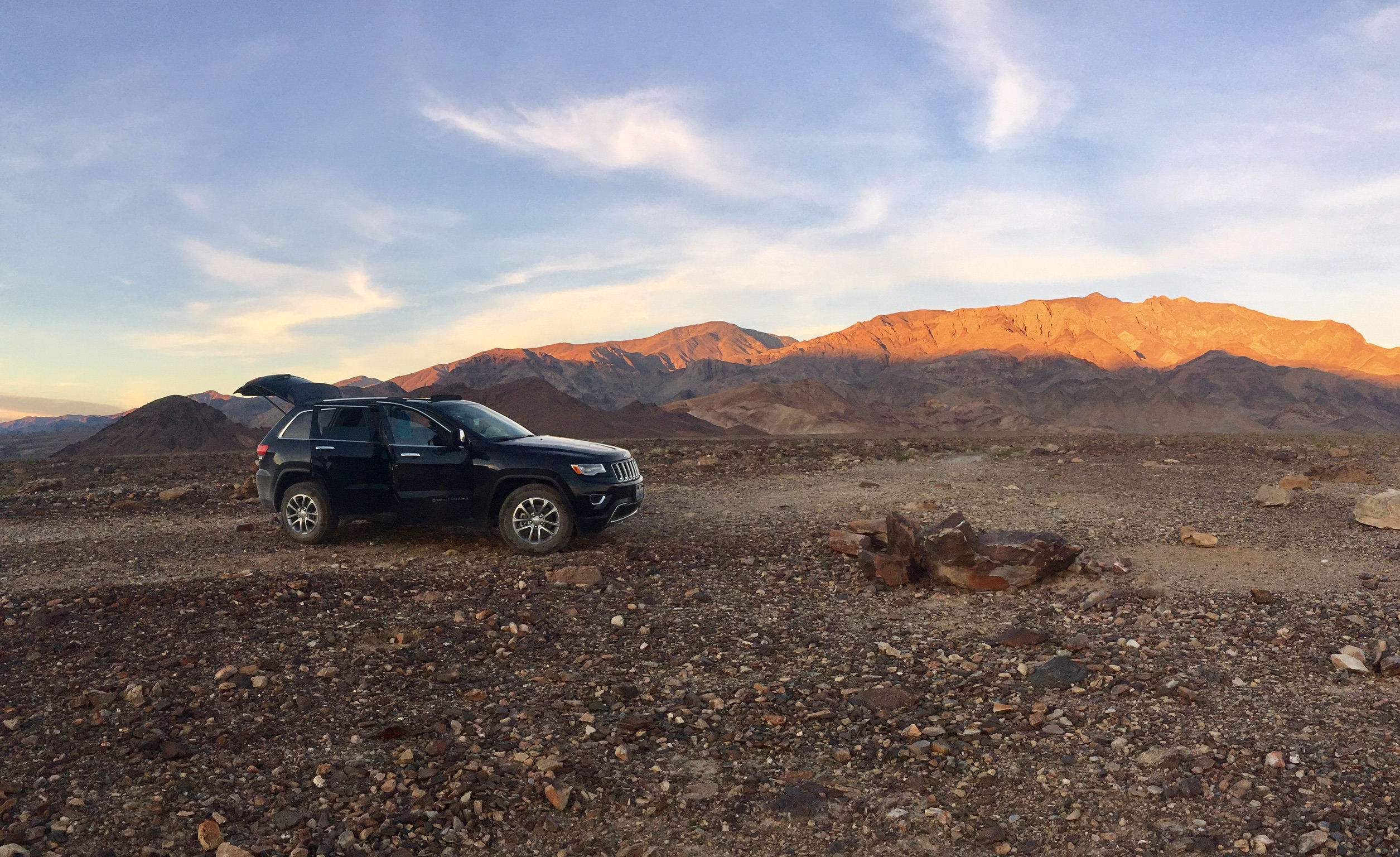
Backcountry Camping on the East Side
There are a lot of backcountry camping options within Death Valley. Below is the guide to where you can and cannot pull off and camp within the park, and some photos of our campsite off of West Side Road.
Backcountry Camping is allowed…
1 mile away from any developed area, paved road, or ‘day use only’ area. Backcountry campsites must be more than 100 yards away from any water source to protect these fragile areas. On the eastern side of the park, there are a number of dirt roads and backcountry sites leading up into the mountains off of West Side Road, which is where we stayed (Note: You can’t camp on West Side Road, but you can camp on most roads leading to the mountains off of it). From there, you can see the valley, salt flat, and both mountain ranges surrounding the main valley basin.
Backcountry Camping is not allowed…
On the following ‘day use only’ dirt roads: Titus Canyon Road, Mosaic Canyon, Natural Bridge Road, Grotto Canyon, Pinion Mesa, Big Pine Road, West Side Road, Wildrose Road, Skidoo Road, Aguereberry Point Road, Cottonwood Canyon Road (first 8 miles only), Racetrack Road (from Teakettle Jct to Homestake Dry Camp).
Camping is not allowed within one mile of any historic mining areas. It also is not allowed on the valley floor from Ashford Mill in the south to 2 miles north of Stovepipe Wells; on the shifting sands of Eureka Dunes; or within one mile of Greenwater Canyon.
Other Information…
Overnight group size is limited to 12 people and 4 vehicles per campsite (if you have more, you’re to split into multiple groups and travel at least ½ mile apart). Campfires are only allowed in designated campgrounds (for obvious reasons), and gathering / burning wood is not allowed in the backcountry. However, camp stoves and gas burning backpacking stoves are allowed.
Timelapse of us driving back out of West Side Road toward Badwater Road.
Timelapse of us driving into West Side Road toward our campsite.
Regular Camping
There are a number of regular camping options in Death Valley, and allegedly sites are always available. If you drive to Furnace Creek, you will find a number of campgrounds there that only cost $13/site/night.
Food & Libations
There aren’t many food / amenities / libations options within Death Valley. However, there are a few cool, old-Western-vibey restaurants and bars in Furnace Creek and Stovepipe Wells. Fun fact – I had the best chile con queso of my life at the Saloon in Stovepipe Wells. Stovepipe also has a small village, ranger station, and water filling fountain. The park Visitor Center is located in Furnace Creek, which also has a large resort.

Comments